TrackAsia Address Convert API – A Practical Solution for the Administrative “Transition” Era
When Vietnam’s administrative boundaries undergo major changes in 2025, what worries businesses is not only data inaccuracy but also the chaos in operations, delivery, and order processing. Familiar addresses suddenly become “non-existent” to the system – and this is where TrackAsia provides a practical solution.
Delivery errors and failed routing
E-commerce websites display errors when entering addresses
CRM – ERP data becomes mixed between old and new addresses
Higher return rates and rising operational costs
While global mapping platforms like Google Maps have yet to fully update the new administrative system, TrackAsia has taken the lead by developing a specialized API suite tailored for the Vietnamese market — featuring the Address Convert API, which allows businesses to seamlessly “bridge” between old and new addresses within milliseconds.
TrackAsia Address Convert API – The Bridge Between Old and New Addresses
This API converts addresses in both directions: from the old administrative system to the new one and vice versa. Designed for rapid integration across platforms (web, mobile, POS, ERP…), it helps businesses standardize address data, synchronize systems, and eliminate errors caused by administrative restructuring.
✨ Key Features:
Bidirectional Conversion: Old ➜ New or New ➜ Old
Flexible Input: Accepts address strings, optionally with coordinates for higher accuracy
Supports JSON or XML Output: Choose the format that fits your integration
Standardized Results: Returns both the converted and corresponding address
Optimized performance for Vietnam’s address data
📌 Example Usage:
Convert Old Address to New:
GET https://maps.track-asia.com/api/v2/place/convert/json?text=Landmark 81 720A Đường Điện Biên Phủ, Phường 22, Quận Bình Thạnh, Thành phố Hồ Chí Minh&migrate_type=old_to_new&latlng=10.795067,106.722045&key=public_key
OUTPUT
{ “results”: [ { “formatted_address”: “Landmark 81 720A Đường Điện Biên Phủ, Phường Thạnh Mỹ Tây, Thành phố Hồ Chí Minh”, “address_components”: [ { “long_name”: “Landmark 81 720A Đường Điện Biên Phủ”, “short_name”: “Landmark 81 720A Đường Điện Biên Phủ”, “types”: [] }, { “long_name”: “Phường Thạnh Mỹ Tây”, “short_name”: “Thạnh Mỹ Tây”, “types”: [“locality”, “political”] }, { “long_name”: “Thành phố Hồ Chí Minh”, “short_name”: “Hồ Chí Minh”, “types”: [“administrative_area_level_1”, “political”] } ], “migrate_type”: “old_to_new” } ] }
Convert New Address to Old:
GET https://maps.track-asia.com/api/v2/place/convert/xml?text=Landmark 81 720A Đường Điện Biên Phủ, Phường Thạnh Mỹ Tây, Thành phố Hồ Chí Minh&migrate_type=new_to_old&latlng=10.795067,106.722045&key=public_key
OUTPUT
{ “results”: [ { “formatted_address”: “Landmark 81 720A Đường Điện Biên Phủ, Phường 22, Quận Bình Thạnh, Thành phố Hồ Chí Minh”, “address_components”: [ { “long_name”: “Landmark 81 720A Đường Điện Biên Phủ”, “short_name”: “Landmark 81 720A Đường Điện Biên Phủ”, “types”: [] }, { “long_name”: “Phường 22”, “short_name”: “Phường 22”, “types”: [“locality”, “political”] }, { “long_name”: “Quận Bình Thạnh”, “short_name”: “Bình Thạnh”, “types”: [“administrative_area_level_2”, “political”] }, { “long_name”: “Thành phố Hồ Chí Minh”, “short_name”: “Hồ Chí Minh”, “types”: [“administrative_area_level_1”, “political”] } ], “migrate_type”: “new_to_old” } ] }
🧩 Parameter Notes
text : “Landmark 81 720A Điện Biên Phủ Street, Thạnh Mỹ Tây Ward, Ho Chi Minh City”
migrate_type : old_to_new (convert from old to new address) or new_to_old (reverse).
Ensure accuracy in logistics and delivery operations
Synchronize addresses between internal and partner systems
Support legal verification for real estate and banking sectors
A logistics company in Ho Chi Minh City reported that after July 1st, nearly 15% of their orders were misrouted because the system still stored old addresses. After integrating TrackAsia’s Address Convert API, old and new data were automatically synchronized, reducing errors to almost zero. This not only saved hundreds of hours of manual input but also significantly improved customer satisfaction.
Integrate Now – Don’t Let Your Business Fall Behind
Delayed address updates are not just a technical risk – they directly affect customer experience, operational costs, and brand reputation. TrackAsia’s Address Convert API offers the simplest, most effective, and easiest-to-deploy solution during this nationwide administrative transition.
➡️ Start integrating in just minutes.
➡️ Free trial available with public_key.
➡️ Our technical team is always ready to support your integration process.
👉 Access the API documentation here or contact us for detailed consultation and pricing tailored to your business.
“TrackAsia – Understand every address, perfect every data point – nurturing the vision of a truly smart Vietnam map.”
Top 10 Maps API Providers for Vietnam: International & Local Options
Digital maps today are no longer just tools for displaying location — they have become essential infrastructure for digital transformation, especially in industries like e-commerce, logistics, real estate, and public services. From pinpointing delivery addresses and locating ATMs to verifying the legal boundaries of properties, Maps APIs play an increasingly critical role.
As Vietnam enters the 2025 administrative boundary reform while businesses face growing pressure to reduce operational costs, the key question becomes: Which map platform is most suitable for Vietnamese enterprises today?
International Maps API Platforms
1. Google Maps
* Google Maps API provides global data with a strong ecosystem, but be mindful of high costs and policy changes in Vietnam since 2022.
Google Maps is the most popular digital map platform globally, known for its extensive coverage, powerful ecosystem, tight integration with Google services, and a rich set of APIs for various fields (place search, geocoding, routing, Street View, Places, Distance Matrix…).
The strengths of Google Maps lie in its high-quality, frequently updated data, accurate positioning, and extensive documentation and community support. It is the default choice for many businesses, especially in the initial implementation phase, thanks to its quick “plug-and-play” capability.
However, since 2022, pricing policies and access limits in Vietnam have been adjusted, making large-scale expansion challenging. Businesses need to carefully calculate costs per query, especially when using high-volume APIs like geocoding, routing, or the Distance Matrix.
Best for: Global businesses, large-scale B2C applications, systems deeply integrated with Google Cloud, or mainstream Android/iOS products.
Watch out for: In the Vietnamese market, using the Google Maps API requires careful monitoring of policies, access quotas, and query costs per package. For systems that need to control map budgets at scale or require updates for new administrative boundaries, considering a local alternative is advisable.
2. Mapbox
*Mapbox excels at UI customization and open data integration, helping create unique map experiences. However, costs can rise quickly with scale, and detailed data may not be as consistent as Google’s.
Mapbox is a world-renowned map platform favored for its powerful map interface customization. Unlike platforms focused on pre-existing data, Mapbox allows businesses to combine open data (like OSM) or provide their own sources to design maps that fit their brand, user experience, or specific features.
The platform provides a full suite of tools for displaying vector tiles, creating custom styles, routing, searching, and offers excellent support on both web and mobile. More reasonable costs than Google, combined with a large developer ecosystem and comprehensive technical documentation, make Mapbox a top choice for applications needing a personalized map identity.
Best for: Startups or businesses with strong technical teams who want full control over the map interface, integrate private data, or build products with a distinctive UX/UI.
Watch out for: In Vietnam, Mapbox may face limitations regarding local data accuracy and licensing costs depending on actual usage. Businesses should consider this when implementing solutions that require detailed administrative addresses or high legal validity.
3. HERE Maps
HERE Maps: strong in enterprise-grade routing & fleet optimization; it’s recommended to verify local data and consider the cost model before wide-scale deployment.
HERE Technologies is a veteran map platform from Europe, trusted in large-scale operational systems due to its strengths in advanced routing and fleet optimization. HERE’s API/SDK suite supports specialized vehicle profiles (trucks, containers, buses…), creating distance/time matrices for thousands of points, along with real-time and historical traffic data, and geospatial analysis tools like isochrones and geofencing.
Notably, HERE provides the ability to plan routes with constraints – such as delivery windows, weight limits, restricted roads, and tolls – helping logistics companies optimize their operations to the highest degree.
Best for: Logistics companies, multi-stop transportation, complex supply chains that require route optimization based on real-world operational rules.
Watch out for: In Vietnam, the detail of HERE’s addresses and POIs needs to be verified by industry and region. Additionally, its deployment model is often enterprise-standard, which may exceed the actual needs of SMEs — businesses should run a small pilot to evaluate its effectiveness before scaling up.
4. OpenStreetMap (OSM)
*OpenStreetMap (OSM) is an open-source, free, and flexible project, but since data relies on the community, accuracy is inconsistent – consider this for systems requiring high reliability.
OpenStreetMap (OSM) is a globally renowned open-source map project, likened to the “Wikipedia of maps” — allowing anyone to use its data for free or contribute edits. OSM is built and maintained by its community, offering high flexibility and good integration into web/mobile applications through various open-source APIs and SDKs.
Its standout strength is the freedom of use, with no copyright restrictions, easy customization, and cost savings — suitable for experimental systems, MVP products, academic research, or organizations needing a map with full infrastructure control.
However, due to its reliance on community contributions, the detail and reliability of the data can be inconsistent across different regions. Large cities and densely populated areas tend to have good data, but rural, remote, or specialized areas (like administrative boundaries, planning) may be lacking or not updated in a timely manner.
Best for: Experimental applications, MVP products, organizations needing an open/self-hosted solution, or teams willing to refine the data themselves.
Watch out for: For systems requiring accurate address data, advanced routing, or updates on new administrative boundaries, it’s crucial to thoroughly check OSM’s scope and coverage in the deployment area — or supplement with other data sources to ensure reliability.
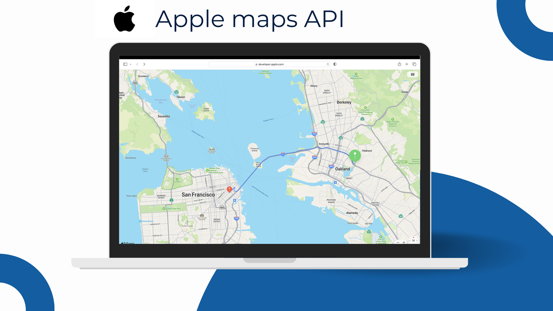
5. Apple Maps
*Apple Maps: ideal for apps within the Apple ecosystem with a smooth native experience; address data in VN needs to be verified per use case, and it’s not geared for deep enterprise routing like specialized platforms.
Apple Maps shines in applications focused on the Apple ecosystem — offering a smooth display experience, native UI/UX, and a strong emphasis on privacy and graphic performance. With MapKit (iOS/macOS) and MapKit JS (web), developers can easily create a consistent experience, supporting light/dark modes, smooth gestures, and good integration with other Apple components.
Strengths
Excellent native experience on iOS/iPadOS; suitable for consumer-first apps that prioritize interface.
A synchronized Apple ecosystem with low friction in development — especially if the percentage of iOS users is high.
Considerations in Vietnam
Address/POI data in VN is uneven compared to Google; it is recommended to pilot based on real use cases (urban vs. suburban).
If you need advanced routing or large-scale matrices, you may need to combine it with other solutions.
MapKit JS requires a developer account, and quotas/costs need to be monitored during expansion.
Local Maps API Platforms
6. TrackAsia
* TrackAsia is not only compatible with the Google API but also offers superior local advantages, supporting both old & new administrative boundaries, with infrastructure in Vietnam for optimal speed, and flexible pricing that is among the most competitive in the country.
TrackAsia is a local Vietnamese Maps API platform that provides both general and specialized Maps API solutions. Fast – Effective – Low Cost, it stands out with its ability to quickly update addresses, high compatibility with other providers’ APIs like Google Maps API or OSM, infrastructure located in Vietnam, and a distinctly competitive price point.
TrackAsia offers a full suite of essential features including place search, geocoding, routing, distance matrix, base tiles, and display tools. The platform supports both old and new administrative boundaries – making it especially suitable for systems that need to adapt promptly to the administrative reclassification changes from July 1, 2025. With servers located in Vietnam, TrackAsia ensures fast response times, high stability, and easy scalability.
Currently, TrackAsia is one of the few providers in Vietnam with the most flexible and preferential pricing in the market, supporting both Pay-As-You-Go and Subscription models — helping businesses optimize costs right from the start. Clear technical documentation, Vietnamese language support, and Google API compatibility make it easy to switch or quickly integrate into existing systems.
Best for: E-commerce, logistics, real estate, fintech, public services — from startups needing low costs to large enterprises requiring a stable, accurate system that is updated with new administrative boundaries.
Watch out for: If migrating from a system using Google Maps, it’s advisable to check the corresponding endpoint list to ensure full compatibility — especially with advanced APIs like matrix routing or real-time traffic.
7. VietMap
*VietMap is a purely Vietnamese map platform, known for its detailed local data and domestic technical support. However, its customization capabilities and international coverage are limited — best suited for domestic systems needing basic on-the-ground accuracy.
VietMap is a long-standing domestic map platform in Vietnam, notable for its detailed local data and a basic API/SDK ecosystem serving display, place search, routing, and geocoding needs.
VietMap’s strength lies in its ability to periodically update data based on fieldwork — especially in small residential areas, deep alleys, or suburban areas where many international platforms often lack detail. The platform also supports a Vietnamese interface and easy integration for popular systems like ride-hailing, delivery, or domestic e-commerce services.
Best for: Domestic systems that require detailed Vietnamese data, have basic display requirements, and do not heavily depend on advanced features or international coverage.
Watch out for: Customization capabilities are limited, advanced APIs are not extensive, and it lacks some functions like route optimization matrix or support for new administrative boundaries. Businesses should test thoroughly with real use cases before deploying at a large scale.
8. Goong
*Goong: A domestic API with smooth vector tile rendering, local payment & support — suitable for domestic needs; it’s recommended to pilot its data/SDK for complex problems before scaling up.
Goong is a domestic Maps API platform developed by a Vietnamese team, known for its smooth display thanks to a modern vector tile architecture, which is highly compatible with web and mobile applications.
The platform provides a basic set of APIs including place search, routing, geocoding, and base tiles, accompanied by an access management dashboard and developer-friendly technical documentation. Goong also supports payments in VND, making it easy to integrate for domestic businesses.
Best for: Small and medium-sized enterprises (SMEs), domestic applications that need a smooth-displaying map, easy integration, and operational support in Vietnamese.
Watch out for: Goong’s underlying data and advanced SDKs are still being improved. For problems requiring routing optimization, support for new administrative boundaries, or high legal requirements, businesses should pilot thoroughly based on real use cases before deploying at a large scale.
9. Map4D
* Map4D: stands out with local 3D/4D display, suitable for smart city & real estate; it’s recommended to pilot data performance when optimal routing or large scale is needed.
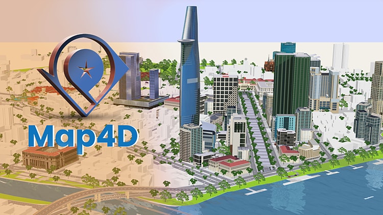
Map4D is a digital map platform developed by a Vietnamese team, notable for its 3D/4D display capabilities – adding a “time dimension” to the map, allowing for simulations of high-rise buildings, landmarks, and urban data layers in real time. Its smooth WebGL renderer, along with 2D/3D SDKs for web and mobile, makes Map4D particularly suitable for smart city, digital tourism, real estate, and virtual tour applications.
In terms of data, Map4D focuses on major cities in Vietnam, providing foundational APIs like search, display, and basic routing. The 3D data layer helps convey brand identity clearly, creating a strong visual impression for B2C products or platforms with a high experiential factor.
Best for: Smart city applications, real estate, digital tourism, and projects that require vivid 3D spatial presentations.
Watch out for: The documentation ecosystem and developer community are not as extensive as international platforms. For systems that prioritize optimal routing, accurate geocoding, or handle high query volumes, it’s advisable to pilot early to verify the backend data capabilities and performance scalability.
10. eKGIS
* eKGIS is strong in project-based, on-premise & OGC-compliant deployments—suitable for GovTech/enterprises needing data sovereignty and deep customization.
eKGIS is a long-standing GIS integrator in Vietnam, with strengths in map projects for government agencies and large enterprises. Its core strength lies in customization upon request, on-premise/Private Cloud deployment, compliance with OGC standards (WMS/WMTS/WFS), and connecting to cadastral, planning, and urban infrastructure databases. Besides base maps and thematic data layers, eKGIS provides services for tile rendering, basic search/geocoding, and application-level routing (depending on the deployment model).
Best for: GovTech, smart cities, utilities (electricity/water/telecom), and businesses that prioritize data sovereignty and internal control processes.
Watch out for: Implementation time and costs often depend on the project scope, and technical documentation may be scattered across different modules—it’s recommended to pilot early to finalize the scope and performance KPIs.
Choosing the Right Digital Map Platform for Vietnamese Businesses
Maps API is no longer just a supplementary tool; it has become a crucial part of the digital infrastructure — directly impacting user experience, delivery accuracy, and system scalability.
Depending on the scale, industry, and technological orientation, each map platform will have its own pros and cons:
Global businesses needing international coverage and a strong ecosystem: Google
Native iOS apps with smooth UX and a focus on privacy: Apple Maps
Needing strong interface customization and open data integration: Mapbox
Open-source, cost-effective, and not requiring high accuracy: OpenStreetMap
Complex logistics, routing with constraints: HERE Maps
3D applications, smart city, tourism, real estate: Map4D
For Vietnamese businesses needing to optimize costs, flexible usage models, and a balance of factors, TrackAsia is the right choice for you ✅
In a period where businesses need to tightly control costs, ensure geographical accuracy, and react quickly to administrative changes – choosing the right Maps API platform is a strategic decision.
If your business:
✅ Needs to replace Google Maps but wants to keep the API structure, ✅ Is preparing to update for the 2025 administrative boundary changes, ✅ Wants to optimize map operational costs at a large scale, ✅ Needs to integrate quickly into existing systems (CRM, ERP, App, Website…),
👉 TrackAsia is a local option worth considering.
With its Google API compatibility, updates for both old & new boundaries, infrastructure in Vietnam, fast response speeds, and flexible pricing – TrackAsia is not just an alternative, but a strategic map solution for Vietnamese businesses in the digital transformation era.
TrackAsia: The Connection Between Old & New Addresses – A Transition Solution for Vietnamese Businesses
July 1, 2025 has passed. The major administrative boundary reform in Vietnam has officially taken effect. This is no longer a forecast — it has become reality. And very likely, your system is facing a hidden risk greater than you think.
🛑 Urgent issue:
Most current mapping platforms — including major names like Google Maps, HERE, and OpenStreetMap — still do not fully support the new administrative addresses. This leads to a series of serious consequences:
Logistics systems cannot correctly identify delivery points.
Delivery services are misrouted, delayed, or return goods.
E-commerce websites encounter errors when customers select an address.
Reporting data becomes unsynchronized, affecting decision-making.
Many public administration systems remain “stuck” because they cannot find the new wards/communes.
💥 The risk is not about having no data — but about data not matching reality.
TrackAsia – Vietnam Map API supporting both New & Old Addresses after July 1, 2025
One platform – A complete solution for Vietnam’s administrative boundary problem
TrackAsia is not just a map, but an API platform designed specifically for Vietnam’s administrative boundaries after the July 1, 2025 reform.
While many international platforms are slow to update or do not prioritize the Vietnamese market, TrackAsia has taken the lead by developing a “2-in-1” solution – supporting both Old & New addresses.
🔍 What TrackAsia offers:
✅ Fully updated with the new administrative boundaries: Including 34 provinces/cities with name changes, mergers, or administrative unit upgrades.
✅ Parallel address support: Automatically convert between old and new addresses. Example: from “Ward 8, District 5” → “Chợ Quán Ward, Ho Chi Minh City”.
✅ Integrated official data: Updated from the Administrative Directory of the Government Portal.
Map API set equivalent to international services
TrackAsia provides all familiar API components, making it easy to replace or integrate into existing systems:
🔍 Address search & processing:
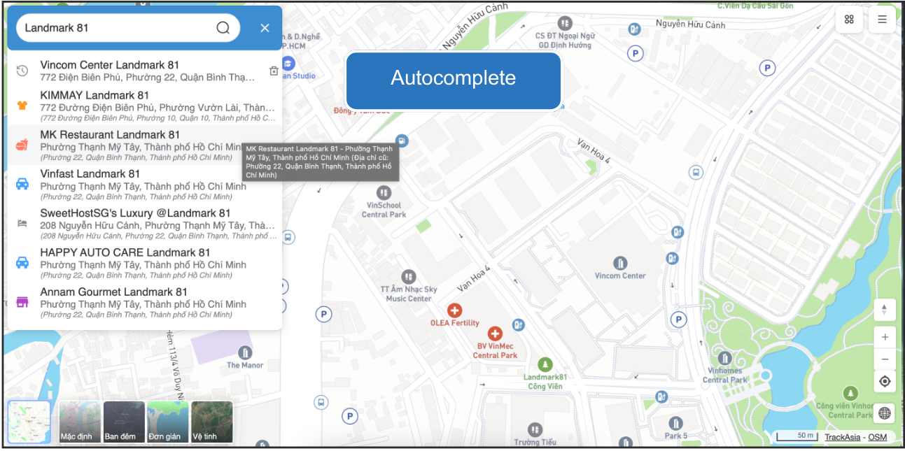
Autocomplete – Real-time address suggestions as users type
“Administrative Bombshell” Has Exploded: Where Are the Invisible Damages?
Imagine this scenario:
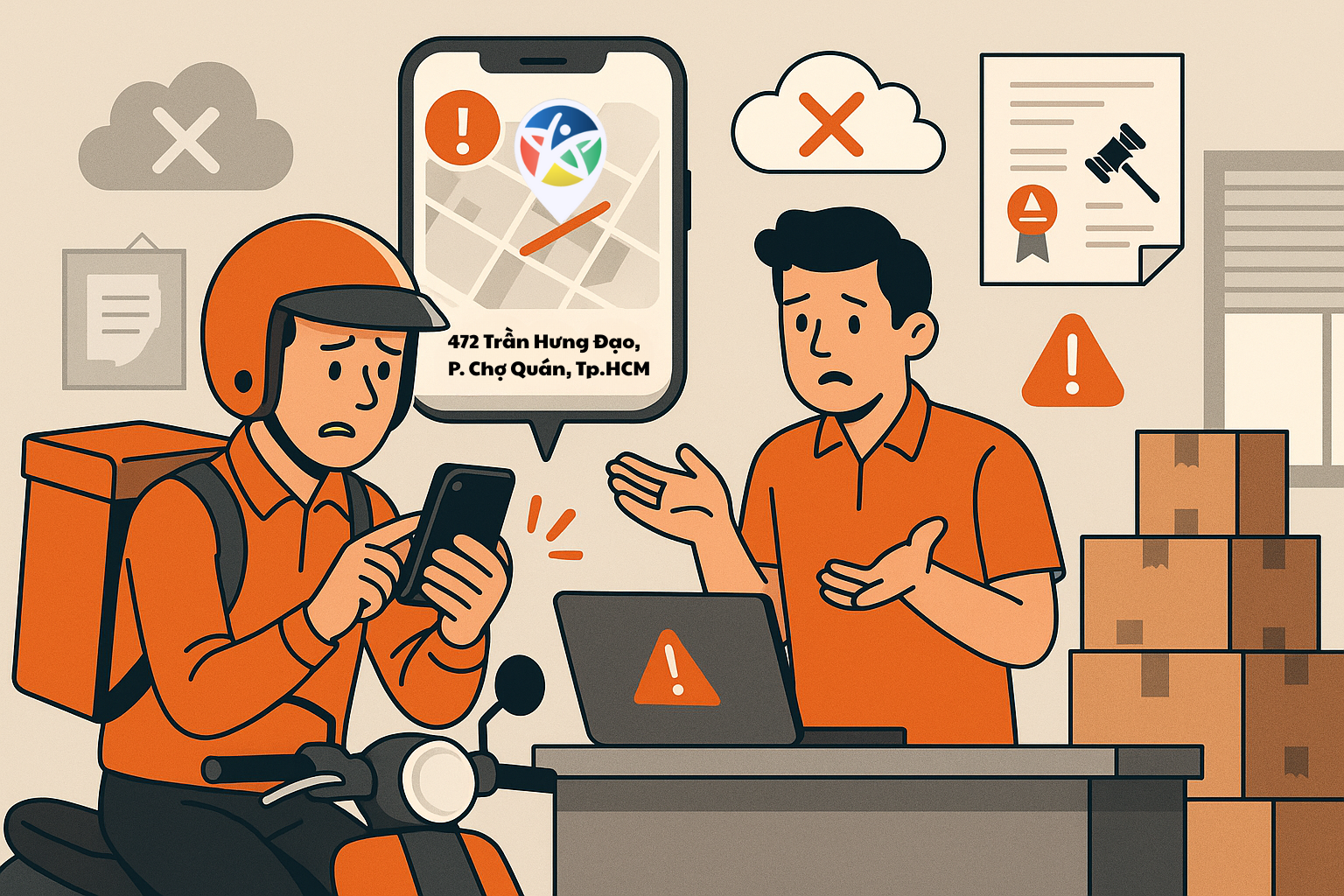
A customer in “Tam Thắng Ward, Ho Chi Minh City” places an order on your website. But the system only knows “Ward 8, Vũng Tàu City” and reports the address as invalid. The customer leaves disappointed. You just lost an order.
Worse, if the order is accepted, the delivery team struggles to find an address that no longer exists on the old map. The delivery fails, operating costs skyrocket, and brand reputation drops.
This is not the customer’s fault or the delivery staff’s fault. This is a system error – something many businesses are paying a high price for because they depend on mapping platforms that cannot keep up with administrative changes.
⚠️ Hidden costs are quietly eating into your profits:
🚚 Errors in delivery & logistics: Higher return rates, increased operating costs due to incorrect address location.
😣 Poor customer experience: Users get confused, lose trust, and easily switch to competitors.
📉 Chaotic internal data: CRM, ERP mixing old and new addresses, making analysis and reporting inaccurate.
Not Just Large Businesses – Small Businesses Are Also Affected
Restaurants, online shops, cooperatives, individual business households – all are affected when administrative boundaries change but systems do not update in time.
Local people may “understand” when the address no longer has the old ward/district, but customers from afar are completely lost.
A common case now is users sharing location via Google Maps, and although the system may navigate correctly, upon arrival the address no longer has the district name, making it extremely difficult to identify or verify the location – especially for delivery services, ride-hailing drivers, or new partners.
TrackAsia API: The solution to adapt to new administrative changes
TrackAsia has fully updated the latest administrative boundaries according to the 2025 resolution. This is one of the few mapping platforms in Vietnam capable of:
✅ Returning both old and new addresses in the same query result ✅ Supporting both old and new systems in parallel, ensuring administrative transitions do not disrupt data ✅ Optimized for industries requiring high legal accuracy such as real estate, finance – banking, logistics, e-commerce…
Example query:
GET https://maps.track-asia.com/api/v2/place/textsearch/json?query=472 Trần Hưng Đạo Street, Ward 2, District 5&include_old_admin=true&new_admin=true
OUTPUT:
{ “predictions”: [ { “description”: “KIMMAY Landmark 81, 772 Điện Biên Phủ Street, Vườn Lài Ward, Ho Chi Minh City”, “name”: “KIMMAY Landmark 81”, “formatted_address”: “772 Điện Biên Phủ Street, Vườn Lài Ward, Ho Chi Minh City”, “old_description”: “KIMMAY Landmark 81, 772 Điện Biên Phủ Street, Ward 10, District 10, Ho Chi Minh City”, “old_formatted_address”: “772 Điện Biên Phủ Street, Ward 10, District 10, Ho Chi Minh City” }, { “description”: “MK Restaurant Landmark 81, Thạnh Mỹ Tây Ward, Ho Chi Minh City”, “matched_substrings”: […] } ] }
👉 Thanks to this, whether customers enter the old address (Ward 2, District 5) or the new address (Chợ Quán Ward), the system can still accurately recognize it.
Why Are International Solutions Like Google Maps Not Fast Enough?
Google Maps is a great tool, but it’s a giant ship. Changing its course to adapt to deeply local adjustments—such as a country’s administrative boundary changes—takes a lot of time.
The problem: Most current mapping platforms, including the big names, still do not fully support the new administrative addresses, causing many technology systems — from logistics, delivery, and e-commerce to public services — to suffer from information errors, incorrect lookups, and data desynchronization. For them, this is just one among thousands of global updates. But for Vietnamese businesses, this is a matter of survival. Their delay in updating means direct risk to your business operations. You can’t afford to wait.
TrackAsia Maps – The “Safety Net” for Vietnamese Businesses
While other solutions are still struggling, TrackAsia has already prepared a comprehensive answer. We not only update maps according to the new boundaries, but also provide an intelligent and flexible conversion mechanism.
Optimized Performance – Minimal Cost
TrackAsia Maps was developed with the philosophy: Efficiency for Vietnamese businesses – Costs that match Vietnam’s reality.
No large budget required
No hidden costs
Lowest price in its segment, while still ensuring superior performance and stability
This is not just a technical advantage — it’s a financial lever for businesses, cooperatives, stores, and distribution systems that need a rapid transition at minimal cost.
Best price, most flexible, diverse on demand – That’s our commitment.
How does it work?
Our API is designed with deep understanding of this “transition” period. It allows your system to:
Accurately search and return the new address.
Simultaneously retrieve and display the old address for comparison, ensuring no one gets confused—from customers to delivery staff.
Fully backward compatible, enabling you to upgrade your system without any disruption.
Simply put, we set up a “safety net” for your data. Whether users enter the old or new address, the system still understands and processes it smoothly.
More Than Just Maps – This Is a Business Advantage
Integrating TrackAsia Maps today is a strategic decision:
🔧 Operational stability: Ensure address data is synchronized and standardized
💰 Maximum cost savings: Reduce address errors, returns, and technical support
💼 Flexible for all scales: From startups to multi-outlet systems, all are easy to integrate
🤝Customer engagement: Create a smooth experience, showing professionalism
The administrative boundary update has begun. Don’t let your business be the one left behind.
Administrative Boundary API Update: Flexible Support for Both Old & New Addresses
July 1, 2025 marks a major milestone as Vietnam officially implements the new administrative boundaries, streamlining from 63 to just 34 provinces and cities. This is not only an administrative change but also raises urgent requirements for updating map data, identification systems, and addresses in technology systems.
To support businesses and developers during this transition, TrackAsia Maps officially upgrades its API with the ability to:
✅ Support searching and displaying addresses according to the new administrative boundaries.
✅ Flexibly switch and retrieve both old and new addresses in parallel.
✅ Backward compatibility, ensuring no disruption to existing systems.
MAP Update: Switch from v1 ➝ v2
If you are using trackasia-gl to display maps, please update your initialization code to the new standard:
Previously (v1):
var map = new trackasiagl.Map({ container: ‘map’, style: ‘https://maps.track-asia.com/styles/v1/streets.json?key=public_key’, center: { lat: 10.762622, lng: 106.660172 }, zoom: 6 });
Now (v2):
var map = new trackasiagl.Map({ container: ‘map’, style: ‘https://maps.track-asia.com/styles/v2/streets.json?key=public_key’, center: { lat: 10.762622, lng: 106.660172 }, zoom: 6 });
Note: v2 uses the latest map dataset, compatible with the new administrative boundaries effective from July 1, 2025.
– By default, the API returns addresses according to the old administrative boundaries (before July 1, 2025) to ensure compatibility with current systems.
The search/autocomplete /place detail APIs have been updated to support the new administrative units. Users can easily adjust API behavior via 2 new parameters:
1. new_admin=true
When added to the query, the API will return addresses according to the new administrative boundaries (updated after July 1, 2025). If this parameter is not provided, the API will default to the old address for backward compatibility.
2. include_old_admin=true
This parameter is used together with new_admin=true so the API returns both new and old addresses in parallel. The old address will be shown in fields prefixed with old_*
{ “formatted_address”: “336 Trương Công Định, Phường Tam Thắng, Thành phố Hồ Chí Minh”, “address_components”: […], “old_formatted_address”: “336 Trương Công Định, Phường 8, Thành phố Vũng Tàu, Tỉnh Bà Rịa-Vũng Tàu”, “old_address_components”: […] }
The new address reflects the post-merger administrative unit: Ward Tam Thang, Ho Chi Minh City
The old address is still fully accessible: Ward 8, Vung Tau City, Ba Ria-Vung Tau Province
Compatible with both old and new data: Your system, partners, and customers may be using different address versions.
Reduce delivery and routing errors: Displaying both helps increase accuracy and reduce confusion.
Prepare for nationwide transition: Proactively updating helps you stay ahead instead of reactively handling issues.
USAGE SUGGESTIONS
When displaying addresses to end users: Use include_old_admin=true to show both old and new addresses, avoiding confusion.
When syncing backend systems: You can call new_admin=true to start gradually updating data to the new standard.
When processing orders, CRM, ERP, logistics: Should record both to support accurate lookup, comparison, and historical analysis.
TrackAsia is committed to supporting businesses, developers, and the ecosystem during Vietnam’s administrative boundary transition. With this update, you can:
Proactively manage data according to the new standard
Ensure system flexibility and stability
Minimize risks when addresses change
If you need technical support or implementation advice, the TrackAsia team is ready to assist you!
Administrative Boundary Changes and the Emerging Challenges and Risks in the Information Technology Sector
New Map, New Rules: Vietnam’s Transport Industry Transforms Ahead of the Administrative “Earthquake”
July 1, 2025 marks a historic milestone for Vietnam’s administrative map, as the number of provinces and cities is streamlined from 63 to 34. This change is not just on paper but represents a powerful “earthquake,” especially for businesses in the transport and delivery sector.
Renaming, code changes, and boundary adjustments for thousands of communes, wards, and towns are posing a major challenge: – How can the massive IT systems in the logistics industry adapt promptly, avoid service disruptions, and ensure a seamless customer experience?
Let’s join TrackAsia in a deep-dive analysis of the challenges, potential risks, and strategic solutions to help businesses confidently weather this “storm” of change.
Integrating administrative boundary updates into IT systems: Government agencies publish new data and maps. For example, in Hanoi, cadastral maps for 126 communes and wards have been updated to accurately reflect the new boundaries. Enterprise IT systems can integrate this data through map APIs and administrative databases.
Internal GIS systems also need updates: digital maps, geolocation data, region code tables, and place names. Update steps include: collecting the new administrative listings, standardizing address names, linking old and new administrative codes, and re-entering data into CRM, ERP, TMS, WMS, etc. Synchronization across all platforms is mandatory to avoid data inconsistencies. During the initial roll‑out, many cadastral maps are incomplete or inconsistent, and new commune/ward boundaries may be unclear. This makes it difficult for businesses to correctly identify addresses, segment delivery zones, or process location data.
– Example: A location name may be recorded differently across sources, especially in areas undergoing mergers or splits. Some areas lack clear boundary maps, complicating system processing. Therefore, tech companies must proactively review, cross‑reference multiple sources, and update flexibly — even using user feedback to ensure map accuracy reflects local reality.
Without input data standardization, businesses are prone to conversion errors. Using automation tools (APIs or middleware) helps ensure no orders get lost due to incorrect place names.
– Furthermore, boundary changes also create challenges for many user groups. Many residents still remember and use old addresses, causing entry and lookup confusion for deliveries or administrative procedures. While younger users can quickly adapt via web or mobile apps, older adults or children may struggle to distinguish between new and old addresses, increasing the risk of service errors.
Challenges for Transport and Delivery Businesses
Changes to delivery zones and shipping rates: Administrative boundary changes require recalculation of delivery fee formulas. Without updates, systems may miscalculate shipping charges.
Disrupted delivery routing: Automated routing systems must adapt to new data flows. Using outdated maps may lead to incorrect directions and suboptimal routing.
Mapping apps and APIs: Many businesses rely on third‑party maps. If partners haven’t updated their data, search results may be inaccurate.
Confusion between old and new addresses: Inconsistent address entry by users and staff can lead to delivery failures or lost orders.
Data entry discrepancies: If input addresses aren’t standardized, mismatched data affects search, routing, transactions, and reporting.
Need for software synchronization: All software systems—online (web/app) and offline (POS, warehouse systems, etc.)—must update address data, user profiles, customer databases, and delivery addresses. Missing any platform may cause operational errors or processing issues.
Economic Impact and Competitive Factors
Delays and errors in the update process not only frustrate customers but also directly affect a company’s profitability and competitive position.
Rising operating costs: Routing mistakes lead to longer distances, higher fuel consumption, and increased labor costs. Handling misaddressed or returned orders manually consumes additional time and resources.
Branding and communication costs: Changes to ward, district, or province names may force businesses to redesign signage, banners, promotional videos, printed materials, and ongoing campaigns. This incurs extra design‑print‑production costs and time to revise materials across all offline and digital channels.
– Although Official Letter 4370/BTC-DNTN 2025 and Article 63 of Decree 01/2021/NĐ‑CP state that businesses aren’t required to update their registered license if only the administrative unit name changes, in practice, updates are still needed for signage, transaction documents, and invoice or contract templates. These hidden changes, if unplanned, lead to significant unanticipated costs.
Revenue decline: Customers losing trust may switch to competitors if service is unstable. Canceled or delayed orders directly reduce revenue.
Brand reputation damage: In a fiercely competitive market, even a few major incidents can severely damage a company’s reputation, making it harder to attract and retain customers.
Competitive advantage: Businesses leading in data updating and standardization gain a strong edge by optimizing operations and delivering superior customer experiences.
Data and system update costs: To synchronize new addresses, companies must invest time and staff to audit, edit, and update data across all systems. This process also requires cross-checking, testing, and ensuring consistency, especially in organizations with many departments and interlinked processes. Without supporting tools, costs can skyrocket and disrupt operations. Using standardized administrative data from partners like TrackAsia helps shorten deployment time, reduce errors, and optimize technical costs.
Potential Risks and Customer Impact
Data incidents: Mismatched address data can delay deliveries, generate incorrect locality on invoices, and complicate lookup and complaint resolution.
Operational errors: Systems not updated in time can confuse staff. Auto‑classification and routing software may malfunction.
Service disruption: Users may encounter errors when placing orders or need to cancel or adjust manually due to unrecognized addresses.
Supply chain impact: Incorrect addresses in contracts, invoices, or licenses may cause legal disputes or delay registrations.
Outdated delivery apps: Many apps still display old administrative addresses, causing driver errors, cancellations, or delays.
Postal and conversion tools: Online old–to–new address conversion tools help improve flexibility and reduce mistakes.
Data standardization: Using a standardized address dataset ensures systems function accurately despite boundary changes.
Real business example: Advn Global is currently located at 472 Tran Hung Dao, Ward 2, District 5, Ho Chi Minh City. After administrative boundary changes, the new address becomes 472 Tran Hung Dao, Cho Quan Ward, Ho Chi Minh City. If not updated promptly in identification systems, orders sent to the old address may be returned or misdelivered.
Strategic Approaches
Standardize and update data: Audit and normalize addresses across systems. Update new administrative codes and use address verification tools.
Store old–new addresses in parallel: Allow systems to accept both formats to ensure operational continuity and reduce confusion.
Automation and API integration: Integrate map APIs and boundary databases for automatic updates.
Use artificial intelligence: Employ AI to process complex addresses, normalize and match data, and support lookups.
Maintain boundary history: Record changes over time to ensure accuracy and easy retrieval of historical data.
Industry-wide standardization and data collaboration: Share datasets with partners, government, and map platforms. Promote postal code standardization.
Staff training: Train operations teams on boundary changes, address verification, and data checking before creating orders.
Conclusion: – Administrative boundary changes pose a significant challenge to the transport and delivery sector. Without thorough preparation, IT systems can fail, causing service disruptions and diminishing customer experience. To succeed, businesses must prepare early, test thoroughly, update data comprehensively, and collaborate closely with stakeholders.
TrackAsia Maps, with its rapid administrative data update capability, is a reliable solution in this context.
Are you having trouble using the Google Map API in your project in Vietnam? Google’s restriction on this service has significantly impacted many businesses. So what is the real reason and is there a more optimal solution? Let’s find the answer with TrackAsia.
1. Geographical Location
The main reason behind the restriction of Google Map API in Vietnam is related to some unclear border issues on islands and seas. These factors have inevitably led to the restriction of Google Map API in Vietnam.
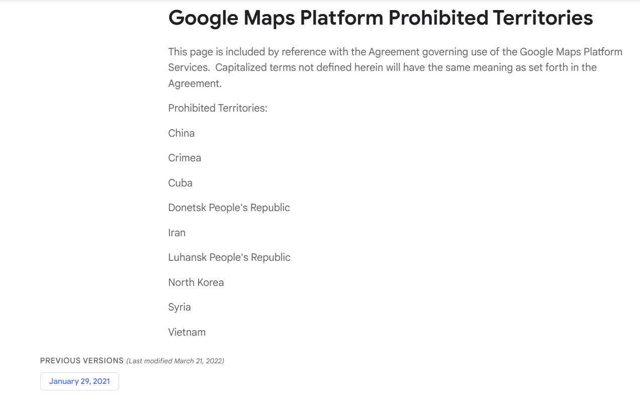
Additionally, according to documents from Google Maps Platform, Vietnam has been listed among the “Prohibited Territories” along with countries like North Korea, Iran, and Syria. This confirms that Google’s restriction policy is not only related to geographical factors but also stems from legal and political constraints.
For example, territorial disputes in the South China Sea have made Google cautious in displaying geographical information accurately and objectively. See details
2. Censorship
Vietnam’s strict content control policy to ensure cybersecurity and social order is also one of the reasons why Google restricts its services.
3. Data Storage
Another factor is the control over data storage in Vietnam. By requiring international technology service providers to have database infrastructure in Vietnam, Vietnam can maintain control over the data stored on the servers of international technology service providers in Vietnam to comply with Vietnamese law.
4. Seeking Solutions
In this situation, many businesses have quickly shifted to domestic digital map solutions to ensure stability and safety for their business operations.
TrackAsia – Comprehensive digital map solution for Vietnamese businesses
With a frequently updated and highly accurate data bank. TrackAsia confidently offers a perfect alternative to the Google Map API. Our product not only meets all mapping and positioning requirements but also helps businesses optimize workflows and enhance operational efficiency.
Google Maps: Comprehensive Overview of Recent Updates and Comparison with Vietnamese Digital Map Platforms
In recent years, the digital mapping landscape has undergone significant transformations, driven by advancements in technology and the growing demand for accurate and accessible location information. Google Maps, the world’s leading digital mapping company, has consistently introduced new features and updates to enhance user experience. In 2023, Google Maps rolled out a series of updates, introducing features such as immersive view, live traffic updates, and eco-friendly routing. These updates have further cemented Google Maps’ position as a leading digital mapping platform. These updates include:
● Immersive View: Immersive view provides a photorealistic representation of famous landmarks, allowing users to virtually explore destinations before visiting them.
● Eco-Friendly Routing: Google Maps now prioritizes eco-friendly routes, helping users reduce carbon emissions by choosing routes that consume less fuel.
● Live Traffic Updates: Real-time traffic updates ensure users are informed about current traffic conditions, allowing them to make informed decisions about their travel plans.
● Enhanced Indoor Maps: Google Maps has expanded its indoor mapping capabilities, providing detailed maps of airports, shopping malls, and other indoor venues.
● Personalized Recommendations: Google Maps uses machine learning technology to provide personalized recommendations for places to visit, dine, and activities to experience.
The Context of Vietnam’s Digital Maps
In recent years, Vietnam’s digital mapping platforms have witnessed significant growth, with several homegrown platforms emerging to cater to the needs of local users. These platforms have made significant strides in providing accurate and updated map data, tailored to Vietnam’s unique geographical and cultural context.
Vietmap: Vietmap is another leading digital mapping platform in Vietnam that has attracted a significant user base. The platform is known for its detailed map data, especially for rural and remote areas of Vietnam. It offers a limited set of features compared to Google Maps and Map4D, but it remains a useful tool for navigating Vietnam. Some of its features include:
● Detailed maps of major cities in Vietnam
● Turn-by-turn driving directions
● Street view for some cities
● Public transport information for some cities
Map4D is a Vietnamese digital mapping platform designed specifically for the Vietnamese market. It offers many similar features to Google Maps, but it also has some unique features tailored to local needs, such as:
● Detailed maps of rural Vietnam
● Vietnamese language support
● 3D and 4D maps for enhanced display
● Integration with Vietnamese transportation services
Track-Asia: an independent, efficient, and cost-optimized digital mapping system deployment solution. TrackAsia was created with the mission to meet the practical needs in the development of technology and the increasing demand for map usage by all businesses in Vietnam. Unique features of Track-Asia:
● Geocoding
● Distance Matrix: a function that provides distance and travel time for a matrix between starting points and destinations.
● Autocomplete: this function helps users search for information easily and quickly by entering just a few characters or keywords.
● Map view
● Routing
● Map SDK
Vietnam’s Digital Mapping Platforms: Serving Local Needs
Vietnam’s digital mapping platforms have gained traction in recent years due to their ability to address the specific needs of local users. These platforms often provide more detailed information about local businesses, attractions, and transportation options, making them more suitable for Vietnamese users.
Additionally, Vietnam’s digital mapping platforms are increasingly incorporating features that cater to local preferences, such as Vietnamese voice navigation and local language search support. These efforts to enhance user experience are contributing to the growing popularity of Vietnam’s digital mapping platforms.
Embracing the Future of Digital Mapping
As we have seen, both Google Maps and Vietnam’s digital mapping platforms are committed to providing users with innovative and user-centric solutions. Google Maps continues to push the boundaries of technological advancements, while Vietnamese platforms are gaining momentum by catering to the specific needs of local users. Ultimately, the future of digital mapping lies in the seamless integration of global expertise with local insights, empowering users to explore the world with confidence and ease.
The choice between Google Maps and Vietnam’s digital mapping platforms ultimately depends on the specific needs and preferences of the user. For users who prioritize global coverage, comprehensive features, and advanced technology, Google Maps remains the preferred choice. However, for users who prioritize detailed local information, tailored features, and Vietnamese language support, Vietnam’s digital mapping platforms offer an attractive alternative. As both Google Maps and Vietnam’s digital mapping platforms continue to evolve, users can expect even more innovative features and enhanced user experiences in the years to come.
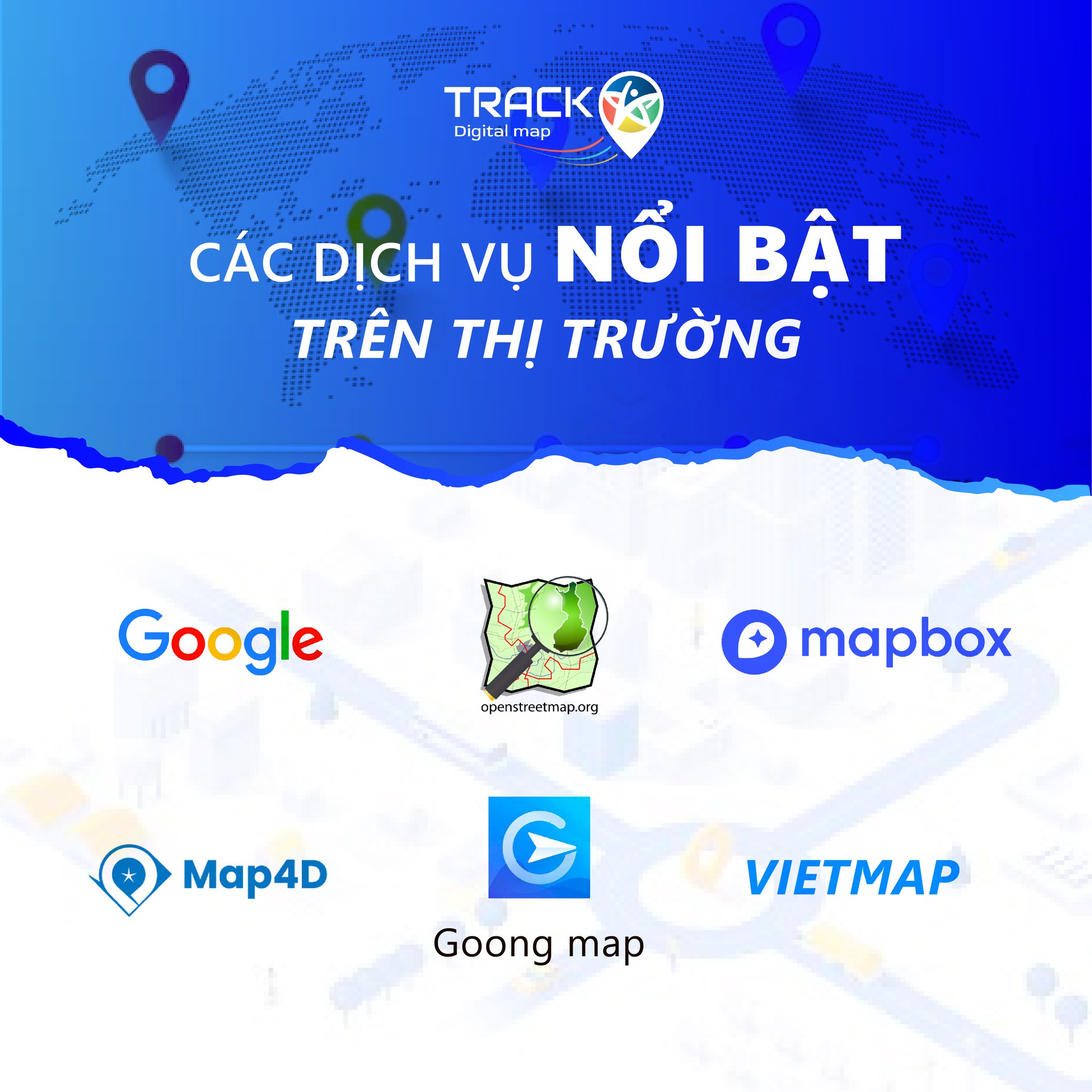
Explore International and Vietnamese Map Solutions
Today, let’s explore the world of map solution services and learn about the outstanding features
of some famous international and domestic map solution providers, and of course,
Track-Asia cannot be missed!
International Map Giants
1. Google Maps
This name is already familiar to almost all users worldwide,
Google Maps provides detailed and updated maps globally. With many features
such as real-time traffic updates, street view for exploration, and route
suggestions based on location, Google Map is also considered a reliable companion
no matter where you are in the world.
2. OpenStreetMap
With abundant and completely open resources, OpenStreetMap provides a flexible
map service platform. The most notable feature of OpenStreetMap, widely known,
is its open community-driven database, allowing users to contribute and customize
maps. This has made OpenStreetMap ideal for projects requiring highly customizable
map solutions and databases.
3. Mapbox
As a map setup platform for developers, Mapbox is highly rated
for its excellent customization options. Mapbox allows developers to create
interactive, highly customizable maps with precise design control and easy
integration into other applications, making it a suitable choice for map
service developers.
Digital Map Providers and Developers in Vietnam
1. VietMap
Vietmap provides digital map services for base maps (Tile Map); address and location
search (Searching); routing and optimal routing (TSP, VRP) to meet the needs
for digital maps domestically and internationally.
2. Goong Map
Goong Maps possesses a rich and continuously updated data repository across all provinces
in Vietnam. This data system is entirely built and updated by Goong. However,
the current Goong Maps API is only developed and data collected within Vietnam’s territory.
Additionally, the location information searched is not yet rich and accurate.
3. Map4D
Map 4D displays detailed locations on the map in 3D images, allowing real-time
weather updates and routing. Although it is cheaper than Google and has its own
database, Map4D still needs to overcome the drawbacks of slow and heavy loading,
incomplete and inaccurate data, and a search function that is not smart and user-friendly.
4. Track-Asia
Track-Asia is an advanced map solution designed specifically for businesses
in Vietnam and the region. With simplified operations and in-depth real-time
information, routes and itineraries are optimized by TrackAsia with easy and
simple integration capabilities. Track-Asia can adapt to almost all businesses
of all sizes, providing customization capabilities to meet specific needs.
Additionally, TrackAsia offers in-depth insights into Vietnam’s geographical
space with frequently and fully updated routes. With an ideal price, TrackAsia
ensures businesses receive quick support with seamless integration into existing
systems, contributing to enhancing efficiency and driving growth for businesses
across Vietnam.
Discover the difference with Track-Asia today and elevate your business!
Are you looking for a domestic map API solution to replace expensive international map API services?
Nowadays, digital maps are an indispensable tool for many businesses, especially in logistics, e-commerce, real estate, and many other industries. International map API platforms like Google Maps, HERE Maps, or Mapbox offer powerful features but come with increasing costs, putting financial pressure on small and medium-sized businesses. Therefore, the need to find a domestic map API solution that is cost-effective yet fully functional is becoming more urgent than ever.
TrackAsia – A comprehensive and cost-effective digital map API solution
TrackAsia is an advanced digital map platform developed to provide a perfect alternative to international map APIs at a reasonable price, suitable for Vietnamese businesses. With modern technology, accurate map data, and flexible customization capabilities, TrackAsia has become the top choice for many businesses in Vietnam.
Why should you replace international map APIs with TrackAsia?
More reasonable cost
International map platforms often have high prices, especially when businesses expand their usage scale. TrackAsia offers various flexible service packages, from “Pay as you go” models to Subscription packages, optimizing costs for all needs.
Optimized support for the Vietnamese market
Map data is optimized to suit the terrain, addresses, and traffic characteristics in Vietnam, providing businesses with more accurate experiences compared to international platforms.
High performance and response speed
With server infrastructure located in Vietnam, TrackAsia ensures fast loading speeds and low latency, optimizing the experience for users and business systems.
Easy integration and use
Fully supports necessary APIs, from Geocoding, Routing, Distance Matrix, Static Maps to Autocomplete, making it easy for businesses to integrate into applications or websites.
Flexible support policy
TrackAsia’s technical support team is always ready to advise and help businesses quickly integrate systems and resolve issues during use.
TrackAsia’s map API services
TrackAsia offers many map API services that fully meet the needs of businesses:
Geocoding API: Converts addresses to geographic coordinates and vice versa, helping to accurately determine locations.
Routing API: Plans optimal routes, suitable for traffic and logistics.
Distance Matrix API: Calculates distances and travel times between multiple locations.
Static Maps API: Provides high-quality static maps for integration into websites and applications.
Autocomplete API: Smart location suggestions to enhance user experience.
Does TrackAsia have all the features to replace international map APIs?
The answer is YES. With comprehensive features, high accuracy, reasonable costs, and scalability, TrackAsia can completely replace the international map APIs that businesses are using. Especially with flexible pricing packages, TrackAsia helps businesses save significant costs without affecting service quality.
Act now!
If you are looking for a cost-effective, efficient, and optimized digital map solution for the Vietnamese market, TrackAsia is the perfect choice for you. Discover the powerful features of TrackAsia and start your journey to enhance your business performance today!
The Role of Digital Maps in the Digital Transformation of Vietnam’s Logistics Service Industry
Vietnam’s logistics service industry is undergoing a rapid digital transformation,
driven by the increasing adoption of digital technologies such as artificial intelligence,
big data, and the Internet of Things (IoT). Digital maps are playing a crucial role in
this transformation by providing logistics service providers with the data and
insights they need to improve efficiency, optimize operations, and deliver better
customer service.
Digital maps are being used by logistics service providers in Vietnam to:
● Plan and optimize delivery routes: Digital maps can
be used to identify the shortest and most efficient routes between delivery points,
taking into account factors such as traffic congestion, road conditions, and
weather. This can help logistics service providers save time and fuel, while also
reducing their carbon emissions.
● Track shipments in real-time: Digital maps can be used to
track shipments in real-time, providing logistics service providers with
visibility of their goods’ location at all times. This can help improve customer
satisfaction by providing customers with updated delivery estimates.
● Manage warehouse operations: Digital maps can be used to manage warehouse
operations, such as optimizing inventory locations and tracking the movement of goods.
This can help improve warehouse efficiency and reduce costs.
● Provide customer service: Digital maps can be used to provide
customer service, such as giving customers real-time delivery updates and allowing
them to track their shipments online. This can help improve customer satisfaction
and loyalty.
Benefits of digital maps in the logistics industry
The use of digital maps is bringing several benefits to the logistics service industry in Vietnam, including:
● Increased efficiency: Digital maps can help logistics service providers enhance
efficiency by optimizing routes, tracking shipments in real-time, and
managing warehouse operations.
● Cost reduction: Digital maps can help logistics service providers reduce
costs by saving time and fuel, while also reducing the need for manual data
entry.
● Improved customer service: Digital maps can help logistics service
providers improve their customer service by providing customers with updated
delivery estimates and allowing them to track their shipments online.
The future of digital maps in the logistics industry
The use of digital maps in the logistics service industry will only grow in
the future. As digital technologies continue to evolve, we can expect
to see even more innovative applications of digital maps in the logistics industry. For example,
we may see the development of self-driving trucks using digital maps to navigate
their routes. We may also see the development of drones using digital maps to deliver goods to remote
locations.
Track-Asia and Vietnam’s logistics industry:
Recognizing the role of digital maps in the digital transformation of Vietnam’s logistics industry
as mentioned in the sections above, the Track-Asia digital map platform was created to meet
the needs of applying information technology suitable for the characteristics of each Vietnamese transport enterprise.
Features of Track-Asia:
⦁ Geocoding: converts geocoded addresses to national addresses and converts national
addresses to geocoded addresses that users can understand.
⦁ Distance Matrix: mapping and routing application to calculate time, distance,
and routes for multiple transport vehicles.
⦁ Autocomplete: search function combined with automatic suggestions to help
users find accurate and relevant locations.
⦁ Map view: detailed and optimized map display according to transmission. Compatible with all
different types of devices such as Web/Mobile.
⦁ Routing: navigation and mapping refer to the process of determining the best or
optimal route between two or more locations.
⦁ Mobile SDK: SDK simplifies the development process by providing built-in functions
that can be easily integrated into applications quickly.
From the above features of Track-Asia, logistics companies can integrate into
their app or website to perform the following transport monitoring features:
❖ Helps businesses and customers easily manage and monitor order routes.
❖ Monitor order status and driver location visually on the map through
the system and app
❖ Monitoring system, notifying the actual transport status if there are any issues including:
driver change, vehicle change, sub-route change, route reversal, etc.