Switching Map API Providers Without Rebuilding Your System
26/09/2026
Switching Map API Providers Without Rebuilding Your System
Yes—if the business treats migration as a controlled process rather than replacing the entire platform at once. The most important work is not changing an API key; it is identifying dependencies, normalizing data, and testing against real operating conditions.
When Map API costs rise, support no longer meets expectations, or a business wants greater control over its data, switching providers becomes an option. Yet many engineering teams delay the decision because mapping is deeply embedded in the product: the UI uses a proprietary SDK, the backend calls several APIs, place data is stored in the old format, and operations depend on familiar results.
That concern is justified. Two providers may both offer basemaps, geocoding, and directions while differing in parameters, response structures, error codes, distance calculations, and data quality. Simply replacing an endpoint and expecting everything to behave as before often produces hard-to-spot errors.
Even so, most businesses do not need to rebuild the entire system. A more practical approach is to break migration down by function, build only the integration layer that is needed, and shift traffic in stages. Stable business processes can remain in place; only components directly tied to the provider need to change.
1. What “without rebuilding everything” actually means
A Map API migration almost always requires some code changes. The reasonable goal is to limit their scope: preserve order creation, dispatch, pricing, customer management, and other core workflows while replacing or adapting the connection to the mapping service.
If the application already separates mapping from business logic, the work may be confined to a few adapters and UI components. If provider SDK calls are scattered throughout the codebase, the first step is to bring those calls behind a common interface. This is targeted refactoring, not a product rebuild.
The goal of a sound migration: replace the mapping infrastructure while keeping the business behavior that users and operations teams rely on stable.
2. Inventory every dependency before changing code
A common mistake is to inspect only screens that display a map. In a live system, mapping services may appear in many more places: web and mobile applications, the backend, background jobs, data stores, reports, and internal tools.
A basic inventory should cover:
Basemaps, markers, marker clusters, polygons, service areas, and custom data layers.
Place search, autocomplete, geocoding, and reverse geocoding.
Directions, distance matrices, ETAs, and route optimization.
SDKs, UI libraries, data types, and utilities specific to the current provider.
Place IDs, coordinates, normalized addresses, polylines, and route results stored in the database.
Each dependency should be linked to a particular business workflow. Geocoding used to suggest an address as a customer places an order matters differently from geocoding used to enrich an end-of-day report. That distinction helps set the migration order.
The inventory should also record volume, peak periods, acceptable latency, and ownership. This provides a baseline for comparison instead of judging a new provider by intuition or a handful of sample requests.
3. Migrate one function at a time
Basemaps, geocoding, search, and directions do not have to move together. Treating them as separate workstreams limits the test surface and gives engineers room to resolve issues in each area before moving on.
Function
Differences to address
How to test in practice
Map display
SDK, layer types, markers, events, styles, and tile loading.
Compare real screens, zoom and pan behavior, multiple data layers, and performance on lower-end devices.
Geocoding
Address structure, precision, result ranking, and classification codes.
Use verified company addresses, including old names, abbreviations, alleys, and incomplete addresses.
Place search
Autocomplete, location bias, language, categories, and place IDs.
Measure correct selections, characters typed before useful results appear, and time to complete an entry.
Compare real delivery routes by vehicle type, area, and operating hours.
Distance matrix
Waypoint limits, directional differences, timeouts, and handling of unreachable locations.
Run real dispatch batches; measure response time and the effect on assignment decisions.
There is no fixed migration order. Many businesses start with the basemap because it is easy to inspect and has limited impact on backend logic. If geocoding or routing drives most of the cost, however, that function may come first as long as the scope is controlled.
4. Standardize the interface—do not force two providers to behave identically
A small integration layer lets the application exchange mapping data through types the business controls. Instead of having multiple modules parse a provider’s geocoding response directly, for example, the system can normalize only what it needs: coordinates, display address, administrative components, confidence level, and data source.
The layer should handle essential differences in parameter names, response structure, error codes, timeouts, retries, and logging. It should not become a new mapping platform filled with abstractions the business never uses.
Nor should the team assume both providers can return identical results. One may return an address as a single string while another returns separate fields; a provider-specific place ID cannot be reused with another service. Normalize for shared business needs, and isolate and document proprietary features.
Avoid over-standardizing. If the application only needs coordinates, a display address, and a place type, the adapter only needs to guarantee those fields. A focused design is easier to test and maintain.
5. Test Vietnamese addresses with real data
A demo using a few well-known places cannot establish integration quality. Operational address data in Vietnam often includes old and new street names, changed ward and commune names, abbreviations, alleys, irregular house numbering, locally known place names, and map pins that differ from the formal address.
Build a reference dataset from the company’s own verified orders, delivery points, warehouses, and locations. It should span provinces and cities, urban centers and outlying areas, and include correct, incorrect, incomplete, and ambiguous entries.
An HTTP 200 response is not enough. For search and geocoding, assess correct-match rates, coordinate error, recognition of address components, and the share of entries that staff must correct manually. For routing, check whether directions fit the vehicle type, road restrictions, and real operating practices.
If the system has verified location data, keep it in the company’s own data store where the applicable terms permit, rather than geocoding it again on every request. This lowers cost and limits unintended changes during migration.
6. Run both providers in parallel before users see the difference
After integrating the new provider, the system should go through a parallel-run period. A sample of requests can go to both the old and new services; the new results are logged for comparison but do not yet affect users or business decisions.
This shadow-traffic approach is particularly useful for geocoding, search, and directions. Engineers can track success rates, latency, differences in results, and the query groups with the largest gaps. Sensitive data should be filtered or handled according to the company’s privacy policy before being sent to either service.
For expensive functions, there is no need to duplicate all traffic. A representative sample by area, time of day, vehicle type, and workflow is often more informative than a much larger set of random queries.
Parallel results should be assessed for business impact. A small coordinate difference may be immaterial in a summary report but critical for doorstep delivery. A shorter route is not necessarily better if it sends a truck onto a restricted road.
7. Shift production traffic in stages
Once the parallel run meets its acceptance criteria, the business can direct some live traffic to the new provider. The split can be based on percentage, internal user group, geography, application, or a specific function.
Internal pilot: start with operations staff or an environment where behavior can be watched closely.
Small canary release: move a low percentage of production traffic and monitor both technical and business metrics.
Conditional expansion: increase the share gradually while latency, error rates, and output quality remain within agreed thresholds.
Make the new provider primary: use it by default while retaining the ability to switch back during stabilization.
Complete the migration: remove the old integration only after reviewing data, logs, contracts, and support procedures.
Feature flags or routing configuration allow engineers to change traffic shares without redeploying the whole application. Mobile SDKs need a separate backward-compatibility plan because older app versions can remain on users’ devices for a long time.
8. Design the rollback before the cutover
Rolling back is not always a matter of reverting a configuration value. If data formats have changed, a new app version has shipped, or results from the new provider have been written into the system, the return path may be more involved than expected.
A rollback plan should specify:
Which metrics trigger it: error rate, latency, failed address searches, or effects on orders.
Who decides to roll back and who carries it out.
Which configuration, credentials, and quotas must remain active with the old provider.
Which data can be shared, which must be converted, and which must be discarded.
How to handle older mobile apps, caches, and jobs already in progress.
The rollback should be rehearsed in a test environment and tried on a small production segment. A plan that exists only on paper still carries substantial risk.
9. Measure more than uptime during migration
Infrastructure metrics show whether a service is running, but not whether the migration is succeeding. Track three groups of measures together:
Metric group
Examples to monitor
What it tells you
Technical performance
p50/p95/p99 latency, timeouts, error rates, quotas, and load handling.
Whether the service meets operational needs, including peak periods.
Whether the output fits Vietnamese data and operating conditions.
Business outcomes
Order creation time, on-time delivery rate, support requests, and cost per transaction.
Whether the technical change is affecting day-to-day operations.
10. When migration becomes a larger project
Not every system can be migrated quickly. The work expands when business logic directly depends on proprietary place IDs; stored data is subject to terms that prevent its use with another service; an SDK appears across many screens; or the current provider’s routes and ETAs have become implicit assumptions in dispatch algorithms.
Specialized features also need separate assessment. Street-level imagery, live traffic, indoor data, visualization tools, or specialized optimization services may have no close equivalent. The business can migrate standard functions first and keep a proprietary feature for a time instead of forcing everything to move together.
Review contracts and data terms early. Caching rights, retention periods, post-termination use of results, and attribution requirements can directly shape the migration design.
11. A practical migration path
Map the dependencies: functions, code, data, traffic, costs, and owners.
Set acceptance criteria: quality, latency, error rates, cost, and business impact.
Choose a clearly scoped function: do not begin with the most complex workflow before the team has learned the process.
Build an adapter and common data model: normalize only what the application needs; avoid unnecessary abstraction.
Run regression and load tests: use real data with appropriate anonymization or protection.
Run in parallel: compare results without affecting users.
Canary and expand traffic gradually: watch both technical and operational measures.
Keep rollback available: retain the old integration long enough to handle uncommon cases.
Finish and clean up: update documentation, training, monitoring, and contracts; retire old components in a controlled way.
How TrackAsia can support assessment and migration
TrackAsia offers basemaps, place search, geocoding, and directions built on open map data for deployments in Vietnam. A business can start with one function or a share of its traffic rather than replacing the entire system at once.
During assessment, engineers can compare results using real addresses and routes, identify where normalization is needed, and then plan a parallel run and controlled traffic shift. This keeps the architecture simple, reduces disruption, and avoids adding an integration layer that is hard to maintain.
Depending on current usage, moving from a proprietary platform to TrackAsia may reduce Map API costs by around 50–70%, while maintaining a 99.9% SLA, reducing infrastructure maintenance work, and giving the business more control over operational data. Actual savings must be validated against each company’s functions, traffic, and quality requirements.
Conclusion
Switching Map API providers without rebuilding the entire system is feasible, but not by changing an endpoint in one step. Businesses need to know where their dependencies lie, migrate by function, normalize only what matters, and test against real operating conditions.
With a parallel-run period, a mechanism for shifting traffic, and a clear rollback path, changing providers becomes a measurable, controlled engineering project. The lasting value is not just one successful migration, but a system that is easier to adapt when the next decision comes.
Assess your migration options with real data
TrackAsia can work with your engineering team to inventory dependencies, test real addresses and routes, and build a phased migration plan.
Build a Map Platform or Use a Map API: How Should Businesses Calculate the Total Cost?
Running an in-house platform can provide greater control. A Map API can shorten deployment time and reduce the technical burden. But comparing an API bill with server rental alone leaves out some of the largest costs: people, data, operations, and risk.
As mapping requirements grow, many businesses face a choice: continue using a Map API or build their own platform with open data and open-source software. On paper, the comparison seems simple. One option charges per request, while the other requires servers but carries no fee for each query.
In practice, these two models cannot be compared through a single cost line. A business mapping platform includes more than a basemap. It may need place search, geocoding, directions, distance matrices, data updates, performance monitoring, backups, and incident response.
Businesses therefore need to look beyond which option appears cheaper today. Usage volume, team capability, and the role of maps in daily operations determine which approach has the more reasonable total cost of ownership.
1. Building a map platform is an ongoing operational responsibility
Building in-house does not mean creating all road data from scratch. Businesses commonly use open data such as OpenStreetMap together with open-source components to deploy private services. Data and software, however, are only the raw materials. Turning them into a stable production platform still requires substantial work.
The work begins with data: downloading it, importing it into a database, building indexes, and keeping it synchronized. Next come the services the application actually needs, which may include basemaps, address search, geocoding, reverse geocoding, directions, or distance matrices.
Once the platform is running, the workload shifts to servers, storage, bandwidth, caching, load balancing, and backups. The operations team must monitor latency, error rates, capacity, and update processes while upgrading software, applying security patches, and checking compatibility.
Real-world data is often the harder part. Addresses may be incomplete, use former names or abbreviations, or point to the wrong location. A route can also be technically correct while remaining unsuitable for the way a business operates.
Worth remembering: open-source software may carry no license fee, but a production platform built from it still requires infrastructure, data, staff, and on-call responsibility.
2. A Map API includes the service behind each request
With a Map API, a business is buying more than the right to send requests. Much of the value comes from having a platform ready to use: data has been processed, services have been deployed, capacity can scale, errors are monitored, and infrastructure is maintained.
Depending on the plan, API fees often cover query infrastructure, scaling capacity, data updates, and maintenance of the underlying services. Businesses may also receive tools for managing keys, quotas, analytics, and alerts, along with integration documentation and incident support.
In other words, the monthly fee transfers part of the technical workload to the provider. The product team must still manage how the application uses the APIs, but it does not have to maintain the entire platform behind them.
The trade-off is a degree of dependence on the provider’s pricing policies, terms of use, data formats, and service availability. Using an API is therefore not a reason to ignore architecture. The integration should remain simple enough to control request volume and support future changes.
3. Do not compare API fees with server rental alone
This is one of the most common budgeting errors. A Map API bill is a clear monthly figure. The cost of running an in-house platform is spread across cloud resources, staffing, development time, on-call work, and data operations. If API fees are compared only with server costs, the in-house option will almost always look cheaper than it really is.
Cost area
Build and operate in-house
Use a Map API
Initial investment
Research, infrastructure setup, data import, optimization, and testing.
API integration and adjustments to the interface and business workflows.
Recurring infrastructure
Servers, storage, bandwidth, backups, redundancy, and monitoring.
Usually included in service fees or usage plans.
Specialized staff
Requires backend, DevOps, spatial database, and data-processing expertise.
Mainly requires integration, usage management, and output quality checks.
Data updates
The business builds and maintains its own update process.
The provider is responsible for the data supplied through the service.
Incidents and on-call operations
The business detects, diagnoses, and recovers from incidents.
Responsibility is shared with the provider within the service scope.
Level of control
High, with deep customization possible when the required expertise is available.
Depends on the API scope, contract, and integration design.
4. Separate initial investment from long-term operating costs
For a fair comparison, businesses should evaluate both options over the same period, such as the expected product lifecycle, rather than looking only at the first three months. The budget can then be divided into two groups.
Initial investment
At the beginning, a business must allocate resources to select technologies, design the architecture, and establish development, testing, and production environments. Data must be imported, indexed, and checked before the platform connects to the existing application. The system also needs load, security, redundancy, and recovery testing before it supports real operations.
Long-term operating costs
After launch, cloud resources, bandwidth, and data storage continue to generate costs. The technical team must monitor the platform, maintain the data-update pipeline, upgrade software, and handle incidents. Queries may also need further optimization as volume or geographic coverage changes.
The business must preserve internal knowledge through documentation, training, and handovers. Redundant capacity for peak periods or failures is also part of the budget, even if much of it remains unused during normal operations.
A Map API usually requires less initial investment, but its cost changes with usage. An in-house platform generally has higher startup and fixed costs, while its marginal cost per request may fall once volume is large enough. A break-even calculation is useful only when people and risk are fully included.
5. Staffing costs extend beyond salaries
An in-house platform needs people who understand how it works. If that knowledge sits with only one or two engineers, the business creates another form of internal dependency. Recovery may take longer when the person responsible leaves, moves to another project, or is unavailable during an incident.
Staffing costs should include recruitment, training, documentation, on-call work, and knowledge transfer. The technical team must also keep up with changes to open-source software, operating systems, databases, and related libraries.
This does not mean that building in-house is always the wrong choice. It makes sense when mapping is a capability the business needs to control over the long term, the right team is available, and the company is prepared to maintain operational ownership rather than simply avoid an API bill.
6. Opportunity cost is often overlooked
Opportunity cost is difficult to see, but it can have a large effect on the decision. Time spent repairing data pipelines, tuning routing servers, or fixing map errors cannot be spent improving the core product.
When considering an in-house platform, businesses should assess whether mapping provides a direct competitive advantage or simply supports the main product. If a specialist provider can operate the map platform while the internal team brings an important feature to market sooner, that saved time has economic value.
Delays and outages should be evaluated in the same way. In many cases, the damage from one week of platform problems may exceed the savings generated by operating it in-house.
Opportunity cost does not appear on a cloud invoice. It appears in product delays, slower customer response, and core work that remains unfinished.
7. A more practical TCO formula for mapping
Businesses can begin with a simple formula and then add figures that reflect their operating environment:
Mapping TCO = Implementation + Infrastructure or API fees + Operations staff + Data and updates + Monitoring and redundancy + Incident response + Opportunity cost + Migration cost
For a meaningful comparison, both options must use the same assumptions for users, orders, and request volume. The functional scope must also match, including basemaps, search, geocoding, and directions.
Requirements for response time, availability, redundancy, geographic coverage, and update frequency must be evaluated on the same basis. The calculation should then cover current usage, expected growth, and peak demand.
A comparison has little value if one option includes only a minimum server configuration while the other includes a full SLA, support, and redundancy.
8. When building in-house is a reasonable choice
Building in-house is more suitable when maps and location data directly differentiate the product, or when the business needs customization that standard APIs cannot provide. Large, stable traffic volumes can also make dedicated infrastructure more efficient.
Operational capability is the other requirement. The business needs suitable GIS, backend, and DevOps expertise, especially when internal data, on-premises deployment, or tight control over data flows is required. The maintenance budget must remain available over the long term, even as responsible staff change.
When these conditions are in place, control and customization may be worth more than faster initial deployment.
9. When a Map API is more suitable
A Map API is often the simpler choice when a business needs to launch quickly, has a small technical team, or cannot yet predict traffic. During market validation, investing too early in a private map platform can distract the team without delivering a proportional return.
This approach also makes sense when maps are important but do not need to become an internally operated core capability, and the provider’s standard functions meet most requirements. Service commitments, support, and predictable costs make planning easier.
The main benefit is that the technical team can focus on the company’s own product instead of maintaining infrastructure that does not create a meaningful difference.
10. A hybrid model: businesses do not have to choose only one side
Many businesses do not need to build everything or outsource everything. A hybrid model can keep the data and logic that create differentiation in-house while using managed services for components that demand substantial operational work.
For example, a business can manage its warehouse data, delivery points, and service areas while a provider supplies basemaps and geocoding. Verified addresses can be stored to reduce repeated queries while ordinary traffic continues through the Map API.
A small integration layer can standardize data between the application and provider. For a specialized requirement, the business may operate one function internally while continuing to use managed services for standard functions.
The integration layer should not become a complex platform of its own. It only needs to be clear enough to control data, measure usage, and replace individual components when a real need arises.
11. A practical decision guide
Situation
Approach to evaluate first
What to check
New product with uncertain traffic
Map API
Costs under growth scenarios and the ability to change plans.
Business with proprietary data but limited GIS staff
Hybrid model
Data ownership, integration method, and support scope.
Mapping is a core capability and needs deep customization
In-house or hybrid
Team capability, maintenance plan, and time to break even.
Stable demand and standard functions
Map API
SLA, data quality, total request volume, and technical support.
Private deployment or strict data-control requirements
In-house, private cloud, or a specialized service
Data boundaries, operational responsibility, and redundancy.
12. An evaluation process before making the decision
List the requirements: establish whether the application needs basemaps, search, geocoding, directions, or proprietary data.
Measure actual load: record requests by business workflow, peak traffic, and the rate of repeated queries.
Define the service level: set clear requirements for latency, availability, update frequency, and recovery.
Calculate TCO over the same period: include staff, data, redundancy, incidents, and opportunity cost.
Test with the business’s own data: do not rely on a few popular addresses or one day of low traffic.
Check the ability to change: determine whether individual services can be replaced or whether the application depends directly on one SDK.
Review the decision periodically: the right choice today may change as volume and the team grow.
TrackAsia reduces the mapping infrastructure businesses need to operate themselves
TrackAsia provides Map API infrastructure built on the open mapping ecosystem for businesses that need basemaps, place search, geocoding, and directions in Vietnam. Product teams gain the benefits of open data and open-source technology without taking on all the work of deploying, updating, and monitoring the underlying infrastructure.
Depending on their requirements, businesses can use TrackAsia APIs or discuss a deployment model that better fits their data and operational needs. This approach helps keep the architecture simple, reduce maintenance work, protect operational data, and maintain a 99.9% service level.
For systems currently using proprietary platforms, reviewing traffic and integration design may also reveal opportunities to reduce API costs by 50–70%, depending on the functions, scale, and actual usage pattern.
Conclusion
Building in-house provides control, but it also creates long-term responsibility for data, infrastructure, and people. A Map API speeds up deployment and reduces operational work, but businesses must manage usage costs and avoid becoming too dependent on one provider.
No single option is right for every business. A sound decision is based on total cost of ownership, the team’s actual capabilities, and the value mapping infrastructure creates for core operations, rather than the price of one request or one server.
Review the total cost before choosing an approach
TrackAsia can work with your technical team to review requirements, traffic, and overlooked costs, then build suitable scenarios for your mapping platform.
An attractive price list may help a business reduce costs when signing a contract. In day-to-day operations, however, the total cost of a Map API also depends on how the application generates requests, the quality of the returned data, the effort required to handle exceptions, and the ability to scale as transaction volume grows.
When comparing map providers, businesses often begin with a reasonable question: how much do 1,000 API calls cost? The number is easy to understand, enter into a spreadsheet, and present in a budget plan.
The problem is that one order does not necessarily generate just one API call. A single address search may trigger several autocomplete requests. An existing address may be geocoded again whenever a new order is created. A tracking screen may reload a map or recalculate a route several times without the user noticing.
A low unit price therefore matters only when the business can control the total number of calls, the quality of the results, and the associated operating costs.
1. The API unit price is not the total cost of mapping
The Map API charge shown on an invoice is generally based on usage across services such as map display, place search, geocoding, directions, and distance matrix calculations. This is only the most visible part of the cost.
The actual total cost may also include:
Redundant API calls: repeated queries, requests sent too early while the user is still typing, or unnecessary data reloads.
Cost of correcting inaccurate data: dispatchers fixing addresses, drivers calling customers for confirmation, or deliveries being attempted again because of an incorrect pin.
Integration costs: development, testing, error monitoring, and updates when an API or SDK changes.
Maintenance costs: quota monitoring, API key management, access control, alerts, and incident response.
Scaling costs: pricing or usage terms may change significantly as traffic grows.
Dependency costs: the more tightly a system is coupled to one provider, the harder it becomes to negotiate or migrate later.
A more useful perspective: do not ask only, “How much do 1,000 calls cost?” Ask, “How many API calls and operational exceptions does the business need to handle to complete 1,000 orders?”
2. One user action can generate multiple API calls
The number of Map API calls rarely corresponds directly to the number of users or orders. It depends on how the product is designed.
Searching for an address while the user types
If the application sends a request after every character, an address such as “125 Nguyen Van Linh” may generate many queries before the user selects a result. A suitable debounce interval, minimum character count, and geographic search boundary can substantially reduce unnecessary calls.
Geocoding a known address again
A regular customer may place many orders for the same destination. If the system geocodes the address for every order instead of reusing verified coordinates, the business is paying repeatedly for the same data.
Recalculating routes when nothing significant has changed
A minor interface update does not always require a new directions or distance matrix request. If application logic does not manage state properly, costs can increase without producing any improvement in operational quality.
3. Inexpensive but inaccurate results can create higher costs elsewhere
A successful API response does not necessarily mean that an address has been interpreted correctly. In Vietnam, users may enter abbreviated street names, familiar local landmarks, former administrative names, or incomplete district information.
If an incorrect location is still passed into route planning, the resulting cost does not appear on the Map API invoice. It appears elsewhere:
Dispatchers have to review and correct delivery locations.
Drivers spend time calling for confirmation or turning back.
Incorrect distance estimates reduce the accuracy of trip planning.
Late deliveries affect service commitments.
Incorrect information continues to be reused when no feedback and correction mechanism exists.
When testing a provider, businesses should therefore use their own real-world address data rather than a few popular locations. The match rate, house-level accuracy, suitability for the operating area, and number of cases requiring manual correction should all be measured.
4. Will today’s low pricing still work as volume grows?
A new application may operate comfortably within a free allowance or the first pricing tier. As the numbers of orders, drivers, and internal users increase, the true cost structure begins to emerge.
Before choosing a service, a business should model at least three scenarios:
Scenario
What to assess
Commonly overlooked risk
Current operations
Average traffic, peak hours, and error rates
Estimating by user count instead of actual API calls
Expected growth
Two to five times the volume and the corresponding pricing tiers
Reduced discounts or changes to usage terms
Peak period or event
Capacity, quotas, and response times
Being rate-limited precisely when map services matter most
This calculation helps a business understand the cost of succeeding at scale instead of optimizing only for a pilot deployment.
5. Technical costs are often separated from the Map API budget
A service with a low unit price but unclear documentation, inconsistent responses, or limited troubleshooting visibility may require much more engineering time to integrate and maintain.
Practical questions to ask include:
How long will the development team need to complete the integration?
Is there a testing environment and tooling for monitoring usage?
When results are abnormal, does the business have enough information to trace the cause?
Will SDK updates affect the existing application?
How does the provider support issues involving local data?
Can API keys, quotas, and access permissions be managed separately by environment or project?
Engineering time and downtime are both real costs, even when they do not appear in the map provider’s quotation.
6. A more practical way to calculate the total cost of a Map API
A business does not need an overly complex financial model. It can begin with a simple formula:
Total mapping cost = API fees + Integration and maintenance costs + Exception-handling costs + Downtime costs + Migration costs
To establish inputs for this formula, businesses should measure:
The number of calls by function for each order.
The percentage of duplicate queries that can be cached or reused.
The percentage of addresses requiring manual correction.
The average time needed to resolve one inaccurate-data case.
The engineering hours spent on integration, monitoring, and troubleshooting.
The losses or additional work caused when the service is slow or unavailable.
Providers should then be compared using the same dataset, business workflow, and growth scenarios. This prevents decisions from being based on two price lists that do not reflect the same operating conditions.
7. Six ways to reduce costs without changing providers
Measure API calls by business workflow: identify which functions generate the most queries and whether every request is necessary.
Tune autocomplete: apply a minimum character count, an appropriate debounce interval, and a relevant geographic boundary.
Reuse verified data: do not geocode a regular customer’s address again when the information has not changed.
Cache with appropriate controls: store permitted results and set retention periods that comply with the service terms.
Create an exception queue: send only low-confidence addresses to dispatchers rather than reviewing every result manually.
Set budget alerts: detect unusual traffic before it leads to a significantly higher invoice.
8. When is a low price a genuine advantage?
A low price remains an important advantage when it comes with the right conditions:
A clear pricing model that remains predictable as volume grows.
Results that suit the business’s real data and operating area.
Stable APIs, clear documentation, and technical support when issues occur.
An application that controls request volume and reuses data appropriately.
The business retains control over its data and integration architecture.
In other words, good pricing creates sustainable savings only when it is part of a well-designed and well-operated system.
How does TrackAsia help businesses control Map API costs?
TrackAsia provides map infrastructure for businesses that need map display, place search, geocoding, and directions in Vietnam. TrackAsia’s approach is not simply to replace one price list with another. It is to help businesses examine their real traffic and understand how Map APIs are being used within their products.
Depending on scale and usage patterns, businesses can substantially optimize API costs compared with proprietary platforms while maintaining a 99.9% SLA, reducing infrastructure maintenance overhead, and protecting the privacy of operational data.
The greatest value does not come from making a single API call cheaper. It comes from predictable budgets, stable operations, and the freedom to adapt as requirements change.
Not sure how many API calls your system uses for each order?
TrackAsia can help your business review its Map API workflows, identify redundant requests, and build cost scenarios based on real transaction volumes.
Whenever someone asks how TrackAsia operates its map system, they usually expect a grand answer: dozens of architectural layers, a jungle of the latest technologies, and endlessly complex diagrams. That is the familiar picture of a “big system.”
But our real answer goes in the completely opposite direction. If we had to summarize TrackAsia’s operational philosophy in one sentence, it would be: make the system as simple as possible — and keep it that way.
This is not a marketing slogan. It is a core engineering decision, and it directly explains why TrackAsia can operate reliably at a fraction of the typical market cost.
Summary: TrackAsia processes millions of map queries every day. We achieve this not by stacking more technology, but by removing what isn’t needed. A system with fewer components breaks less, is easier to fix, cheaper to operate — and scales more gracefully when the time comes.
1. Why we are afraid of complexity
There is an uncomfortable truth in software engineering: most systems don’t fail because they lack features — they fail because they become too complex to maintain.
Every new technology added, every intermediary layer built, introduces one more thing that can break at 2 AM, one more thing a new engineer will spend weeks trying to understand, and one more hidden cost quietly eating into the monthly budget. Many long-running platforms carry enormous operating expenses not because they do more, but because they are feeding a machine that even they struggle to control.
“Every engineer loves adding new tech to a system. Very few have the discipline to remove things. At TrackAsia, our default question isn’t ‘what should we add?’ — it’s ‘what can we take away?'”
We chose the harder, more disciplined path: every time we face an architectural decision, the first question is always, “Do we truly need this?” If the answer is not a clear “yes,” the answer is “no.”
2. Simplicity is not doing less — it is choosing the right things to do
There is a widespread misconception: simplicity means being basic or half-baked. The reality is the exact opposite. The simplicity TrackAsia pursues is the result of a rigorous filtering process — knowing what not to build is just as important as knowing what to build.
Every team’s resources are finite: time, people, money. The question is never how much you have, but where you direct it. Many platforms make the mistake of spreading themselves thin across dozens of secondary features and technology layers, ending up with nothing that is truly excellent.
TrackAsia follows a principle of focus: all resources go into the core of what customers actually need, and everything outside that is cut away without hesitation.
What we focus on
The quality of map data and Vietnamese addresses — what creates real value every single time a customer calls our API.
The speed and reliability of search and routing — what customers feel every second they use the product.
Service stability — what lets our customers sleep at night.
What we deliberately avoid
Chasing the latest tech trend just because it’s “hot,” while a proven tool already does the job well.
Cramming in features that almost nobody uses, making the product harder to understand and maintain.
Building infrastructure layers far beyond real needs, just to “look large.”
This focus creates a compounding effect: the core product keeps getting sharper, while costs are never inflated by unnecessary extras. Customers get exactly what they pay for — nothing more, nothing less — and they never have to subsidize complexity they will never use.
3. The foundation: fewer components, each doing one thing well
At its core, a map platform needs to solve three problems: storing spatial data, searching addresses, and calculating routes. We built our system tightly around those three things and nothing more.
Spatial data
We use tools that have been proven globally over many years for storing and querying geographic data, rather than reinventing the wheel or chasing unstable new tech. Vietnam’s map data is built on top of open-source OpenStreetMap, which we process and normalize to match the realities of local addresses.
Search and routing
This is where we invest the most effort, because it is what customers experience directly. An address lookup or route calculation must return a result almost instantly. We optimize relentlessly to make these operations fast and trustworthy — not to show off which technology runs underneath.
The principle throughout: each component owns exactly one responsibility and does it extremely well. When something needs fixing or upgrading, we touch only that part, without fear of bringing down everything else. That is a freedom a tangled system can never have.
4. The secret to handling load isn’t computing more
TrackAsia currently processes millions of queries every day. Hearing that number, many assume we must have a massive server farm crunching data around the clock. The reality is the opposite.
The secret to handling large loads isn’t computing faster — it’s not recomputing what has already been computed.
Most real-world queries are repetitive: the same dense urban areas, the same popular addresses, the same well-traveled routes. We cache the results of those queries and return them immediately, rather than forcing the system to recalculate from scratch every time.
As a result, the actual load hitting our core infrastructure is a fraction of what the “millions of requests” headline implies.
When traffic grows, we scale by adding more parallel processing nodes — not by tearing things down and rebuilding. This is precisely why “simple” and “scalable” are not opposites: only a clean, lean system can be replicated so easily.
5. Stability comes from being boring, not brilliant
Good infrastructure is boring — it runs so consistently that people forget it exists at all. That is the goal.
Instead of chasing sophisticated operational techniques just to “look professional,” we focus on the fundamentals and execute them with care:
Updating data without interrupting service: Vietnam’s map changes constantly — new roads, renamed streets, and recently, major provincial administrative mergers. We update our data in a way that never disrupts services already running for our customers.
Proactive system health monitoring: We do not wait for a customer to report a bug before investigating. When a metric shows early signs of trouble, our team knows and acts before it becomes a real incident.
No unnecessary points of failure: The fewer components a system has, the fewer things can go wrong. Simplicity is the cheapest and most effective form of resilience.
6. The real hard problem: understanding Vietnamese addresses
If there is one area where we pour the most genuine effort, it is not infrastructure — it is data and the uniquely challenging problem of Vietnamese addresses.
Addresses in Vietnam present a puzzle that no international technology solves out of the box: homes deep inside alleyways, address numbers like “88/55/12,” an endlessly variable shorthand culture, and most recently, sweeping changes to district and commune names following administrative mergers. A map API is only truly useful when it understands these very “Vietnamese” realities.
This is where we choose to invest, rather than spending money on inflating infrastructure. To us, the value of a domestic map platform doesn’t lie in how “international” it is — it lies in how well it serves the actual operational reality on the ground in Vietnam.
7. Why this story matters for your business
Engineering talk may sound abstract, but this philosophy of simplicity translates directly into tangible value for our customers:
Sustainably lower costs: Low operating costs don’t come from cutting corners on quality — they come from a lean system that costs less to keep running. That is why we can keep API pricing accessible without operating at a loss.
Greater reliability: The simpler the system, the fewer the failure points. You don’t have to worry about your map service going dark in the middle of peak hours.
You stay focused on your business: You are good at selling, delivering, and running warehouses. Let us handle the maps, instead of building and maintaining an internal infrastructure team to do it yourself.
We don’t build a complex system to look “premium.” We build a system that is good enough, and simple enough, so you never have to pay for complexity you don’t need.
Behind TrackAsia is not a showcase of enterprise technology. It is a disciplined choice: keep the system simple and stable, stay tightly focused on the real map problems of Vietnam, and as a result, operate at low cost while remaining genuinely reliable.
If your business needs a map platform that runs quietly, understands Vietnamese addresses, and doesn’t blow up your budget, give TrackAsia a try. Simplicity, it turns out, is the hardest thing to build — and we have already done that work for you.
This article was shared by the TrackAsia team — the digital map platform built for Vietnamese businesses.
Comprehensive Evaluation of OpenStreetMap (OSM) for Businesses: Should You Use It?
04/07/2026
Comprehensive Evaluation of OpenStreetMap (OSM) for Businesses: Should You Use It?
Over the years, OpenStreetMap (OSM) has become one of the most critical open-source geographic data platforms in the world. With its open approach, vast community contributors, and high customizability, OSM is increasingly being considered by businesses as a viable alternative to expensive proprietary map platforms.
However, the key question is not just “Is OpenStreetMap free?”, but rather “How should a business deploy it—via Free Cloud or Self-hosting—and what is the actual economic math?”. To answer this, let’s analyze the deployment models, their pros and cons, operational costs, maintenance, and long-term scalability in detail.
Key Takeaway: OSM is an excellent solution to avoid vendor lock-in and optimize map data licensing costs. However, the choice of deployment model—whether using public Free Cloud servers or self-hosting private servers—comes with significant trade-offs in terms of performance, maintenance overhead, and long-term reliability.
1. What is OpenStreetMap (OSM)?
OpenStreetMap is a collaborative, open-source mapping project built by a global community. Unlike proprietary map platforms that package their data into closed APIs and bill on a per-query basis, OSM gives businesses direct access to raw spatial data under the ODbL license. This data can be processed, rendered, and integrated into internal services (such as routing, geocoding, and map visualization) to solve specific business problems.
2. Comparing Deployment Models: Free Cloud vs. Self-host
When implementing OSM in production, businesses generally choose between two core infrastructural paths:
Model 1: Using Free Cloud / Public Servers
Connecting applications directly to public servers hosted by the OSM Foundation (like tile.openstreetmap.org) or using the free tiers of third-party cloud mapping providers.
Pros:
Zero Infrastructure Cost: No need to purchase hardware or lease VPS/Cloud servers for map processing.
Rapid Deployment (Plug & Play): Takes minutes to copy-paste the Tile Server URL into your frontend code (using Leaflet, MapLibre, or OpenLayers) to display maps instantly.
Zero Maintenance: Data updates, server scaling, and uptime management are fully handled by the community or external providers.
Cons:
Strict Rate Limits: The OSM Tile Usage Policy strictly prohibits heavy commercial usage. If your app sends high request volumes, your IP address will be blocked immediately without warning.
Unpredictable Performance: Load speeds depend entirely on public server load and network bandwidth, leading to high latency or blank map tiles during peak hours.
No SLA or Technical Support: If the servers go down, your services break, and there is no support team to contact for resolution.
Data Privacy Risks: Geocoding and routing queries containing customer coordinates are sent to public servers, which is not suitable for sensitive enterprise applications.
Model 2: Self-hosting (On-premise / Private Cloud)
Building your own server environment (on-premise or renting Cloud VMs on AWS, GCP, DigitalOcean) to install open-source GIS software (PostgreSQL/PostGIS, Tile Server, Nominatim for Geocoding, OSRM/Valhalla for Routing) and importing raw OSM data.
Pros:
Maximum Performance & Autonomy: Ultra-fast map rendering speeds as your team controls the hardware resources. You can scale the system dynamically for peak user hours.
Unlimited Queries: Run millions of daily map loads, geocoding requests, or routing queries without any per-transaction API costs.
Absolute Data Privacy: Customer coordinates, delivery addresses, and driver paths are processed locally within your private network.
Deep Customization: Import custom private roads, restricted areas, or proprietary warehouse points directly into the spatial database to optimize proprietary routing algorithms.
Cons:
High Upfront Investment: Requires powerful server hardware (high CPU cores, large RAM, and enterprise-grade NVMe SSDs to store nationwide or global GIS datasets).
High Technical Complexity: Demands specialized engineering expertise in GIS (Geographic Information Systems), spatial databases, and DevOps for optimal setup and configuration.
Heavy Maintenance Burden: Your team must build and maintain automated pipelines to sync raw OSM updates (minutely/daily/weekly diffs) to prevent maps from becoming outdated. System monitoring, backups, and troubleshooting are 24/7 internal responsibilities.
Slow Time-to-Market: The research, setup, and performance tuning phase can easily take weeks to months before the system is production-ready.
3. Comparison Table: Free Cloud vs. Self-host
Criteria
Public Free Cloud
Self-hosting (Self-host)
Upfront Infrastructure Cost
Zero ($0)
Very High (Server hardware or high-tier Cloud VMs)
Long-term Operational Cost
Zero ($0)
High (Monthly hosting fees + Engineering salaries)
Query Limits (Scale)
Very Low (Risk of IP block under heavy load)
Unlimited (Bound only by your server capacity)
Response Latency
Slow & Unpredictable (Third-party dependent)
Fast & Stable (With proper caching and optimization)
Data Customization
Extremely limited
Fully customizable based on business needs
Information Security
Low (Requests sent over the public internet)
Absolute (All requests processed internally)
Required Engineering Talent
Basic Frontend Developer
GIS Experts, Database Admins, and DevOps Engineers
4. Operations & Maintenance Challenges for Self-hosting
Many businesses opt for Self-hosting due to data security and scale, but often struggle with the operational realities of GIS systems:
Data Bloat: The global OSM dataset (Planet file), once imported into PostgreSQL with full index tables, takes up Terabytes of high-performance SSD space and continues to grow.
Synchronization Pipelines: Keeping data fresh without causing service downtime requires advanced transaction management, especially for real-time logistics apps.
Stack Orchestration: A complete map engine requires coordinating at least four separate services:
Tile Server: Rendering vector or raster map tiles.
Geocoding Server (Nominatim/Photon): Translating addresses to coordinates and vice versa.
Routing Engine (OSRM/Valhalla): Calculating routes, distances, and travel times.
Autoscale & Load Balancer: Distributing request traffic under heavy load.
5. Analyzing Total Cost of Ownership (TCO)
Businesses must recognize: The OpenStreetMap dataset is free, but the infrastructure needed to turn it into an enterprise service is not.
Cost Component
Free Cloud Model
Self-host Model
Data License
$0
$0
Server & Network Bandwidth
$0
$500 – $3,000+/month (scaled with traffic)
Engineering Staff (GIS & DevOps)
$0
Very High (Salaries for mapping specialists)
Opportunity Cost / Downtime Risk
Very High (Loss of revenue if public servers fail)
Medium (Depends on internal incident response capabilities)
Time-to-market
Instant (1-2 days integration)
Slow (3-8 weeks setup, tuning, and QA testing)
6. The Perfect Hybrid Solution from TrackAsia
Faced with two conflicting options—using a Free Cloud with low performance and poor security, or Self-hosting with massive infrastructure and labor overhead—businesses need a middle ground.
TrackAsia bridges this gap by offering a Managed Enterprise Map Platform built on OpenStreetMap:
Managed Infrastructure: TrackAsia invests in and maintains a high-performance map server cluster, providing API endpoints (Tile Map, Geocoding, Routing) backed by a 99.9% uptime SLA.
Zero Maintenance Overhead: TrackAsia’s GIS engineers handle daily OSM updates, route optimization, and 24/7 server monitoring. Your team can completely skip map maintenance.
Flexible Integration: Securely overlay your private location data (warehouses, private routes) on top of TrackAsia’s map layers.
Exceptional Cost Optimization: By leveraging open-source GIS technology, TrackAsia delivers API pricing that helps businesses save 50% to 70% compared to traditional proprietary map platforms without sacrificing enterprise-grade performance.
OpenStreetMap is an invaluable geographic data resource. However, choosing between self-hosting and public free cloud options requires careful evaluation of your Total Cost of Ownership (TCO) and internal engineering capabilities.
If your business needs a reliable, secure, and rapidly deployable map platform without the burden of expensive server management and GIS maintenance, look to TrackAsia to power your location services.
This analysis is tailored for enterprises in logistics, mobility, delivery, real estate, retail, fintech, and digital platforms looking for scalable, secure, and cost-effective mapping solutions over the long term.
Bản đồ số không chỉ là công cụ hiển thị vị trí — mà ngày nay đã trở thành một phần không thể thiếu trong hạ tầng công nghệ số, đặc biệt trong các ngành như thương mại điện tử, logistics, bất động sản, và dịch vụ công. Từ việc xác định chính xác điểm giao hàng, định vị trạm ATM, cho đến xác thực giá trị pháp lý của bất động sản, Maps APIa đang ngày càng đóng vai trò then chốt.
Trong bối cảnh Việt Nam bước vào giai đoạn cải cách địa giới hành chính 2025, đồng thời chịu áp lực tối ưu chi phí vận hành trong nền kinh tế nhiều biến động, câu hỏi đặt ra là: Đâu là nền tảng bản đồ phù hợp nhất cho doanh nghiệp Việt hôm nay?
Nhóm nền tảng Maps API quốc tế
1.Google Maps
* Google Maps API cung cấp dữ liệu toàn cầu với hệ sinh thái mạnh, nhưng cần lưu ý chi phí cao và chính sách tại Việt Nam thay đổi từ 2022.
Google Maps là nền tảng bản đồ số phổ biến nhất toàn cầu, nổi bật với độ phủ rộng, hệ sinh thái mạnh mẽ, tích hợp chặt chẽ với các dịch vụ Google và bộ API phong phú hỗ trợ đa lĩnh vực (tìm kiếm địa điểm, geocoding, định tuyến, Street View, Places, Distance Matrix…).
Điểm mạnh của Google Maps nằm ở chất lượng dữ liệu tốt, cập nhật thường xuyên, khả năng định vị chính xác, và thư viện tài liệu, cộng đồng hỗ trợ lớn. Đây là lựa chọn mặc định của nhiều doanh nghiệp, đặc biệt trong giai đoạn đầu triển khai nhờ khả năng “plug-and-play” nhanh chóng.
Tuy nhiên, kể từ 2022, chính sách giá và giới hạn truy cập tại Việt Nam có sự điều chỉnh, khiến việc mở rộng quy mô sử dụng gặp nhiều thách thức. Doanh nghiệp cần tính toán kỹ chi phí theo lượt truy vấn, đặc biệt khi dùng các API như geocoding, định tuyến hoặc Distance Matrix với khối lượng lớn.
Phù hợp với: Doanh nghiệp toàn cầu, ứng dụng B2C quy mô lớn, hệ thống tích hợp sâu với Google Cloud hoặc sản phẩm Android/iOS phổ thông.
Cần lưu ý: Tại thị trường Việt Nam, việc sử dụng Google Maps API cần theo dõi kỹ chính sách, hạn mức truy cập và chi phí truy vấn theo gói. Với hệ thống cần kiểm soát ngân sách bản đồ ở quy mô lớn hoặc cập nhật địa giới hành chính mới, nên cân nhắc lựa chọn bản địa thay thế.
2. Mapbox
*Mapbox mạnh về tuỳ biến giao diện và tích hợp dữ liệu mở, giúp tạo trải nghiệm bản đồ riêng biệt. Nhưng chi phí có thể tăng nhanh khi mở rộng, và dữ liệu chi tiết chưa đồng đều bằng Google.
Mapbox là nền tảng bản đồ nổi tiếng thế giới, được ưa chuộng nhờ khả năng tùy biến giao diện bản đồ mạnh mẽ. Khác với các nền tảng tập trung vào dữ liệu sẵn có, Mapbox cho phép doanh nghiệp kết hợp dữ liệu mở (như OSM) hoặc tự cung cấp nguồn riêng, để thiết kế bản đồ theo nhu cầu thương hiệu, trải nghiệm người dùng hoặc tính năng chuyên biệt.
Nền tảng này cung cấp đầy đủ các công cụ hiển thị tile vector, tạo style tùy chỉnh, định tuyến, tìm kiếm, và hỗ trợ tốt trên cả web lẫn mobile. Chi phí hợp lý hơn Google, cộng với hệ sinh thái developer lớn và tài liệu kỹ thuật đầy đủ, khiến Mapbox trở thành lựa chọn hàng đầu cho các ứng dụng cần bản đồ mang đậm dấu ấn cá nhân.
Phù hợp với: startup hoặc doanh nghiệp có đội ngũ kỹ thuật mạnh, mong muốn kiểm soát toàn bộ giao diện bản đồ, tích hợp dữ liệu riêng, hoặc xây dựng sản phẩm thiên về UX/UI đặc trưng.
Cần lưu ý: Tại Việt Nam, Mapbox có thể gặp giới hạn về độ chính xác dữ liệu địa phương và chi phí bản quyền tuỳ theo mức truy cập thực tế. Doanh nghiệp nên cân nhắc khi triển khai ở các bài toán đòi hỏi địa chỉ hành chính chi tiết hoặc cần tính pháp lý cao.
3. Heremap
HERE Maps: mạnh về định tuyến & tối ưu đội xe cấp doanh nghiệp; nên kiểm chứng dữ liệu nội địa và cân nhắc mô hình chi phí trước khi triển khai rộng.
HERE Technologies là nền tảng bản đồ kỳ cựu đến từ châu Âu, được tin dùng trong các hệ thống vận hành quy mô lớn nhờ thế mạnh về định tuyến nâng cao và tối ưu đội xe. Bộ API/SDK của HERE hỗ trợ các hồ sơ phương tiện chuyên biệt (xe tải, xe container, xe bus…), lập ma trận khoảng cách/thời gian hàng nghìn điểm, cùng dữ liệu giao thông thời gian thực, lịch sử và công cụ phân tích địa lý như isochrone và geofencing.
Đặc biệt, HERE cung cấp khả năng lập kế hoạch lộ trình có ràng buộc – ví dụ như thời gian giao hàng, giới hạn tải trọng, đường cấm, phí cầu đường… – giúp doanh nghiệp logistics tối ưu hoạt động ở mức cao nhất.
Phù hợp với: doanh nghiệp logistics, vận tải đa điểm, chuỗi cung ứng phức tạp, cần định tuyến tối ưu theo quy tắc vận hành thực tế.
Cần lưu ý: Tại Việt Nam, độ chi tiết địa chỉ và POI của HERE cần kiểm chứng theo từng ngành và khu vực. Ngoài ra, mô hình triển khai thường theo chuẩn enterprise, nên có thể vượt nhu cầu thực tế của các SME — doanh nghiệp nên pilot nhỏ để đánh giá hiệu quả sử dụng trước khi scale up.
4. OpenStreetMap (OSM)
*OpenStreetMap (OSM) là dự án mã nguồn mở, miễn phí và linh hoạt, nhưng dữ liệu phụ thuộc cộng đồng nên độ chính xác không đồng đều – cần cân nhắc khi áp dụng cho hệ thống yêu cầu độ tin cậy cao.
OpenStreetMap (OSM) là dự án bản đồ mã nguồn mở nổi tiếng toàn cầu, được ví như “Wikipedia của bản đồ” — cho phép bất kỳ ai cũng có thể sử dụng dữ liệu miễn phí hoặc tham gia đóng góp chỉnh sửa. OSM được xây dựng và duy trì bởi cộng đồng, với tính linh hoạt cao và khả năng tích hợp tốt vào các ứng dụng web/mobile thông qua nhiều lớp API và SDK mã nguồn mở.
Thế mạnh nổi bật là sự tự do sử dụng, không giới hạn bản quyền, dễ dàng tùy biến và tiết kiệm chi phí — phù hợp cho các hệ thống thử nghiệm, sản phẩm MVP, nghiên cứu học thuật, hoặc tổ chức cần bản đồ có khả năng kiểm soát toàn bộ hạ tầng.
Tuy nhiên, do phụ thuộc cộng đồng đóng góp, nên độ chi tiết và độ tin cậy của dữ liệu có thể không đồng đều giữa các khu vực. Thành phố lớn, khu vực đông dân cư thường có dữ liệu tốt, nhưng vùng nông thôn, vùng sâu vùng xa hoặc khu vực chuyên biệt (như địa giới hành chính, quy hoạch) có thể thiếu sót hoặc không cập nhật kịp thời.
Phù hợp với: Ứng dụng thử nghiệm, sản phẩm MVP, tổ chức cần giải pháp mở/tự chủ hoặc có đội ngũ sẵn sàng tinh chỉnh dữ liệu.
Cần lưu ý: Với các hệ thống cần dữ liệu địa chỉ chính xác, định tuyến nâng cao hoặc cập nhật địa giới hành chính mới, nên kiểm tra kỹ phạm vi và độ phủ của OSM tại khu vực triển khai — hoặc kết hợp thêm nguồn dữ liệu khác để đảm bảo độ tin cậy.
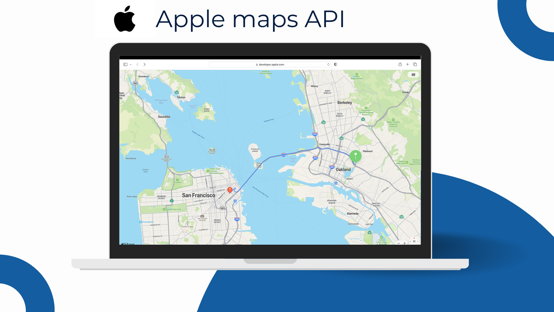
5. Apple Maps
*Apple Maps: lý tưởng cho app trong hệ sinh thái Apple, trải nghiệm native mượt; dữ liệu địa chỉ tại VN cần kiểm chứng theo use case và không hướng enterprise routing sâu như các nền tảng chuyên dụng.
Apple Maps toả sáng ở các ứng dụng tập trung hệ sinh thái Apple — trải nghiệm hiển thị mượt, UI/UX native, chú trọng quyền riêng tư và hiệu năng đồ họa. Với MapKit (iOS/macOS) và MapKit JS (web), nhà phát triển dễ tạo trải nghiệm đồng nhất, hỗ trợ chế độ sáng/tối, cử chỉ mượt và tích hợp tốt với các thành phần Apple.
Điểm mạnh
Trải nghiệm native xuất sắc trên iOS/iPadOS; phù hợp app consumer-first coi trọng giao diện.
Hệ sinh thái Apple đồng bộ, ít ma sát khi phát triển — đặc biệt nếu tỉ lệ người dùng iOS cao.
Cân nhắc tại Việt Nam
Dữ liệu địa chỉ/POI tại VN không đồng đều như Google; nên pilot theo use case thực tế (đô thị vs. vùng ven).
Nếu cần routing nâng cao hoặc ma trận quy mô lớn, có thể cần kết hợp giải pháp khác.
MapKit JS yêu cầu tài khoản developer, quota/chi phí cần theo dõi khi mở rộng.
Nhóm nền tảng Maps API trong nước
6.TrackAsia
* TrackAsia không chỉ tương thích Google API mà còn mang lợi thế bản địa vượt trội, hỗ trợ đồng thời địa giới hành chính cũ & mới, hạ tầng đặt tại Việt Nam cho tốc độ tối ưu, cùng gói chi phí linh hoạt với mức giá cạnh tranh bậc nhất trong nước.
TrackAsia là nền tảng Maps API bản địa việt nam, cung cấp giải pháp API Maps theo yêu cầu chung hay riêng biệt. Nhanh chóng – Hiệu quả – Chi phí thấp, nổi bật với khả năng cập nhật địa chỉ nhanh, tương thích cao với các API của nhà cung cấp khác như Google Maps API hay OSM, hạ tầng đặt tại Việt Nam và mức giá cạnh tranh rõ rệt.
TrackAsia cung cấp đầy đủ nhóm tính năng thiết yếu gồm tìm kiếm địa điểm, geocoding, định tuyến, ma trận khoảng cách, tile nền và công cụ hiển thị. Nền tảng hỗ trợ đồng thời địa giới hành chính cũ và mới – đặc biệt phù hợp với các hệ thống cần thích ứng kịp thời với thay đổi phân cấp hành chính từ 01/07/2025. Với máy chủ đặt tại Việt Nam, TrackAsia đảm bảo tốc độ phản hồi nhanh, độ ổn định cao và khả năng mở rộng dễ dàng.
Hiện tại, TrackAsia là một trong những nhà cung cấp hiếm hoi tại Việt Nam có mức giá linh hoạt và ưu đãi bậc nhất thị trường, hỗ trợ cả mô hình Pay-As-You-Go và Subscription — giúp doanh nghiệp tối ưu chi phí ngay từ giai đoạn khởi đầu. Tài liệu kỹ thuật rõ ràng, hỗ trợ tiếng Việt và tương thích Google API giúp dễ dàng chuyển đổi hoặc tích hợp nhanh vào hệ thống sẵn có.
Phù hợp với: Doanh nghiệp TMĐT, logistics, bất động sản, fintech, dịch vụ công — từ startup cần chi phí thấp đến doanh nghiệp lớn cần hệ thống ổn định, chính xác và cập nhật theo địa giới mới.
Cần lưu ý: Nếu chuyển từ hệ thống dùng Google Maps, nên kiểm tra danh sách endpoint tương ứng để đảm bảo tương thích hoàn toàn — đặc biệt với các API nâng cao như matrix routing hoặc traffic realtime.
7. VietMap
*VietMap là nền tảng bản đồ thuần Việt, nổi bật với dữ liệu địa phương chi tiết và hỗ trợ kỹ thuật trong nước. Tuy nhiên, khả năng tùy biến và độ phủ quốc tế còn hạn chế — phù hợp nhất cho các hệ thống nội địa cần độ chính xác thực địa cơ bản.
VietMap là nền tảng bản đồ nội địa được phát triển lâu năm tại Việt Nam, nổi bật với dữ liệu địa phương chi tiết và hệ sinh thái API/SDK cơ bản phục vụ các nhu cầu hiển thị, tìm kiếm địa điểm, định tuyến và geocoding.
Thế mạnh của VietMap nằm ở khả năng cập nhật dữ liệu định kỳ theo thực địa — đặc biệt tại các khu dân cư nhỏ, hẻm sâu, hoặc khu vực ven đô nơi nhiều nền tảng quốc tế thường thiếu chi tiết. Nền tảng này cũng hỗ trợ giao diện tiếng Việt và tích hợp dễ dàng cho các hệ thống phổ biến như ứng dụng gọi xe, giao hàng hoặc dịch vụ thương mại điện tử trong nước.
Phù hợp với: Các hệ thống nội địa cần dữ liệu Việt chi tiết, yêu cầu hiển thị cơ bản, không phụ thuộc nhiều vào các tính năng nâng cao hoặc độ phủ quốc tế.
8. Goong
*Goong: API nội địa, vector tile hiển thị mượt, thanh toán & hỗ trợ trong nước — phù hợp nhu cầu nội địa; nên pilot dữ liệu/SDK cho các bài toán phức tạp trước khi mở rộng.
Goong là nền tảng Maps API nội địa do đội ngũ Việt Nam phát triển, nổi bật với khả năng hiển thị mượt nhờ kiến trúc vector tile hiện đại, tương thích tốt với ứng dụng web và mobile.
Nền tảng cung cấp nhóm API cơ bản gồm tìm kiếm địa điểm, định tuyến, geocoding và tile nền, đi kèm với dashboard quản lý truy cập và tài liệu kỹ thuật thân thiện với lập trình viên. Goong cũng hỗ trợ thanh toán bằng VNĐ, dễ dàng tích hợp cho doanh nghiệp trong nước.
Phù hợp với: Doanh nghiệp vừa và nhỏ (SME), ứng dụng nội địa cần bản đồ hiển thị mượt, dễ tích hợp và hỗ trợ vận hành bằng tiếng Việt.
9. Map4D
* Map4D: nổi bật với hiển thị 3D/4D bản địa, hợp smart city & bất động sản; nên pilot hiệu năng dữ liệu khi cần định tuyến tối ưu hoặc quy mô lớn.
Map4D là nền tảng bản đồ số do đội ngũ Việt phát triển, nổi bật với khả năng hiển thị 3D/4D – bổ sung thêm “chiều thời gian” vào bản đồ, cho phép mô phỏng nhà cao tầng, địa danh và các lớp dữ liệu đô thị theo thời gian thực. Trình hiển thị WebGL mượt mà cùng SDK 2D/3D dành cho web và mobile giúp Map4D đặc biệt phù hợp cho các bài toán smart city, du lịch số, bất động sản và tham quan ảo.
Về dữ liệu, Map4D tập trung vào các đô thị lớn tại Việt Nam, cung cấp các API nền tảng như tìm kiếm, hiển thị, định tuyến cơ bản. Lớp dữ liệu 3D giúp truyền tải thương hiệu rõ nét, tạo ấn tượng thị giác mạnh cho sản phẩm B2C hoặc nền tảng có yếu tố trải nghiệm cao.
Phù hợp với: ứng dụng đô thị thông minh, bất động sản, du lịch số, dự án cần trình diễn không gian 3D sống động.
Cần lưu ý: Hệ sinh thái tài liệu và cộng đồng developer chưa rộng như các nền tảng quốc tế. Với hệ thống ưu tiên định tuyến tối ưu, geocoding chính xác hoặc khối lượng truy vấn lớn, nên pilot sớm để kiểm chứng năng lực dữ liệu backend và khả năng mở rộng hiệu năng.ăng/khả năng mở rộng.
10. eKGIS
* eKGIS mạnh triển khai theo dự án, on-premise & chuẩn OGC—phù hợp GovTech/doanh nghiệp cần chủ quyền dữ liệu và tùy biến sâu.
eKGIS là nhà tích hợp GIS lâu năm tại Việt Nam, mạnh về các dự án bản đồ cho cơ quan nhà nước và doanh nghiệp lớn. Thế mạnh cốt lõi nằm ở tùy biến theo yêu cầu, triển khai on-premise/Private Cloud, tuân thủ chuẩn OGC (WMS/WMTS/WFS) và kết nối các cơ sở dữ liệu địa chính, quy hoạch, hạ tầng đô thị. Bên cạnh bản đồ nền và lớp dữ liệu chuyên đề, eKGIS cung cấp các dịch vụ hiển thị tile, tìm kiếm/geocoding cơ bản, và định tuyến ở mức ứng dụng (tùy mô hình triển khai).
Phù hợp với: GovTech, đô thị thông minh, điện/nước/viễn thông, doanh nghiệp coi trọng chủ quyền dữ liệu và quy trình kiểm soát nội bộ.
Cần lưu ý: Thời gian triển khai và chi phí thường phụ thuộc phạm vi dự án, tài liệu kỹ thuật có thể phân tán theo từng module—nên pilot sớm để khóa phạm vi và KPI hiệu năng.
Lựa chọn nền tảng bản đồ số phù hợp cho doanh nghiệp Việt
Maps API giờ đây không đơn thuần là công cụ phụ trợ, mà đã trở thành một phần quan trọng trong hạ tầng số — ảnh hưởng trực tiếp đến trải nghiệm người dùng, độ chính xác giao vận, và năng lực mở rộng hệ thống.
Tùy vào quy mô, ngành nghề và định hướng công nghệ, mỗi nền tảng bản đồ sẽ có ưu nhược điểm riêng:
Doanh nghiệp toàn cầu, cần độ phủ quốc tế, hệ sinh thái mạnh: Google
App iOS native, UX mượt, tôn trọng quyền riêng tư: Apple Maps
Cần tuỳ biến giao diện mạnh, kết hợp dữ liệu mở: Mapbox
Nền tảng mở, tiết kiệm, không đòi hỏi độ chính xác cao: OpenStreetMap
Logistics phức tạp, routing có ràng buộc: HERE Maps
Doanh nghiệp nội địa, cần dữ liệu Việt chi tiết: VietMap, Goong
Chính quyền, doanh nghiệp nhà nước, yêu cầu triển khai riêng: eKGIS
Ứng dụng 3D, smart city, du lịch, bất động sản: Map4D
Doanh nghiệp Việt cần tối ưu chi phí,mô hình sử dụng linh hoạt , cân bằng các yếu tố thì TrackAsia là sự lựa chọn phù hợp cho bạn ✅
Trong giai đoạn doanh nghiệp cần kiểm soát chặt chi phí, đảm bảo độ chính xác địa lý, và phản ứng nhanh với thay đổi hành chính – việc chọn đúng nền tảng Maps API là một quyết định chiến lược.
Nếu doanh nghiệp bạn:
✅ Cần thay thế Google Maps nhưng muốn giữ nguyên API, ✅ Đang chuẩn bị cập nhật địa giới hành chính 2025, ✅ Muốn tối ưu chi phí vận hành bản đồ ở quy mô lớn, ✅ Cần tích hợp nhanh vào hệ thống hiện tại (CRM, ERP, App, Website…),
👉 TrackAsia là lựa chọn bản địa đáng cân nhắc.
Với khả năng tương thích Google API, cập nhật địa giới cũ & mới, hạ tầng tại Việt Nam, tốc độ phản hồi nhanh và giá linh hoạt – TrackAsia không chỉ là một phương án thay thế, mà là một giải pháp bản đồ chiến lược cho doanh nghiệp Việt Nam trong thời kỳ chuyển đổi số.
Top 10 Maps API Providers for Vietnam: International & Local Options
Digital maps today are no longer just tools for displaying location — they have become essential infrastructure for digital transformation, especially in industries like e-commerce, logistics, real estate, and public services. From pinpointing delivery addresses and locating ATMs to verifying the legal boundaries of properties, Maps APIs play an increasingly critical role.
As Vietnam enters the 2025 administrative boundary reform while businesses face growing pressure to reduce operational costs, the key question becomes: Which map platform is most suitable for Vietnamese enterprises today?
International Maps API Platforms
1. Google Maps
* Google Maps API provides global data with a strong ecosystem, but be mindful of high costs and policy changes in Vietnam since 2022.
Google Maps is the most popular digital map platform globally, known for its extensive coverage, powerful ecosystem, tight integration with Google services, and a rich set of APIs for various fields (place search, geocoding, routing, Street View, Places, Distance Matrix…).
The strengths of Google Maps lie in its high-quality, frequently updated data, accurate positioning, and extensive documentation and community support. It is the default choice for many businesses, especially in the initial implementation phase, thanks to its quick “plug-and-play” capability.
However, since 2022, pricing policies and access limits in Vietnam have been adjusted, making large-scale expansion challenging. Businesses need to carefully calculate costs per query, especially when using high-volume APIs like geocoding, routing, or the Distance Matrix.
Best for: Global businesses, large-scale B2C applications, systems deeply integrated with Google Cloud, or mainstream Android/iOS products.
Watch out for: In the Vietnamese market, using the Google Maps API requires careful monitoring of policies, access quotas, and query costs per package. For systems that need to control map budgets at scale or require updates for new administrative boundaries, considering a local alternative is advisable.
2. Mapbox
*Mapbox excels at UI customization and open data integration, helping create unique map experiences. However, costs can rise quickly with scale, and detailed data may not be as consistent as Google’s.
Mapbox is a world-renowned map platform favored for its powerful map interface customization. Unlike platforms focused on pre-existing data, Mapbox allows businesses to combine open data (like OSM) or provide their own sources to design maps that fit their brand, user experience, or specific features.
The platform provides a full suite of tools for displaying vector tiles, creating custom styles, routing, searching, and offers excellent support on both web and mobile. More reasonable costs than Google, combined with a large developer ecosystem and comprehensive technical documentation, make Mapbox a top choice for applications needing a personalized map identity.
Best for: Startups or businesses with strong technical teams who want full control over the map interface, integrate private data, or build products with a distinctive UX/UI.
Watch out for: In Vietnam, Mapbox may face limitations regarding local data accuracy and licensing costs depending on actual usage. Businesses should consider this when implementing solutions that require detailed administrative addresses or high legal validity.
3. HERE Maps
HERE Maps: strong in enterprise-grade routing & fleet optimization; it’s recommended to verify local data and consider the cost model before wide-scale deployment.
HERE Technologies is a veteran map platform from Europe, trusted in large-scale operational systems due to its strengths in advanced routing and fleet optimization. HERE’s API/SDK suite supports specialized vehicle profiles (trucks, containers, buses…), creating distance/time matrices for thousands of points, along with real-time and historical traffic data, and geospatial analysis tools like isochrones and geofencing.
Notably, HERE provides the ability to plan routes with constraints – such as delivery windows, weight limits, restricted roads, and tolls – helping logistics companies optimize their operations to the highest degree.
Best for: Logistics companies, multi-stop transportation, complex supply chains that require route optimization based on real-world operational rules.
Watch out for: In Vietnam, the detail of HERE’s addresses and POIs needs to be verified by industry and region. Additionally, its deployment model is often enterprise-standard, which may exceed the actual needs of SMEs — businesses should run a small pilot to evaluate its effectiveness before scaling up.
4. OpenStreetMap (OSM)
*OpenStreetMap (OSM) is an open-source, free, and flexible project, but since data relies on the community, accuracy is inconsistent – consider this for systems requiring high reliability.
OpenStreetMap (OSM) is a globally renowned open-source map project, likened to the “Wikipedia of maps” — allowing anyone to use its data for free or contribute edits. OSM is built and maintained by its community, offering high flexibility and good integration into web/mobile applications through various open-source APIs and SDKs.
Its standout strength is the freedom of use, with no copyright restrictions, easy customization, and cost savings — suitable for experimental systems, MVP products, academic research, or organizations needing a map with full infrastructure control.
However, due to its reliance on community contributions, the detail and reliability of the data can be inconsistent across different regions. Large cities and densely populated areas tend to have good data, but rural, remote, or specialized areas (like administrative boundaries, planning) may be lacking or not updated in a timely manner.
Best for: Experimental applications, MVP products, organizations needing an open/self-hosted solution, or teams willing to refine the data themselves.
Watch out for: For systems requiring accurate address data, advanced routing, or updates on new administrative boundaries, it’s crucial to thoroughly check OSM’s scope and coverage in the deployment area — or supplement with other data sources to ensure reliability.
5. Apple Maps
*Apple Maps: ideal for apps within the Apple ecosystem with a smooth native experience; address data in VN needs to be verified per use case, and it’s not geared for deep enterprise routing like specialized platforms.
Apple Maps shines in applications focused on the Apple ecosystem — offering a smooth display experience, native UI/UX, and a strong emphasis on privacy and graphic performance. With MapKit (iOS/macOS) and MapKit JS (web), developers can easily create a consistent experience, supporting light/dark modes, smooth gestures, and good integration with other Apple components.
Strengths
Excellent native experience on iOS/iPadOS; suitable for consumer-first apps that prioritize interface.
A synchronized Apple ecosystem with low friction in development — especially if the percentage of iOS users is high.
Considerations in Vietnam
Address/POI data in VN is uneven compared to Google; it is recommended to pilot based on real use cases (urban vs. suburban).
If you need advanced routing or large-scale matrices, you may need to combine it with other solutions.
MapKit JS requires a developer account, and quotas/costs need to be monitored during expansion.
Local Maps API Platforms
6. TrackAsia
* TrackAsia is not only compatible with the Google API but also offers superior local advantages, supporting both old & new administrative boundaries, with infrastructure in Vietnam for optimal speed, and flexible pricing that is among the most competitive in the country.
TrackAsia is a local Vietnamese Maps API platform that provides both general and specialized Maps API solutions. Fast – Effective – Low Cost, it stands out with its ability to quickly update addresses, high compatibility with other providers’ APIs like Google Maps API or OSM, infrastructure located in Vietnam, and a distinctly competitive price point.
TrackAsia offers a full suite of essential features including place search, geocoding, routing, distance matrix, base tiles, and display tools. The platform supports both old and new administrative boundaries – making it especially suitable for systems that need to adapt promptly to the administrative reclassification changes from July 1, 2025. With servers located in Vietnam, TrackAsia ensures fast response times, high stability, and easy scalability.
Currently, TrackAsia is one of the few providers in Vietnam with the most flexible and preferential pricing in the market, supporting both Pay-As-You-Go and Subscription models — helping businesses optimize costs right from the start. Clear technical documentation, Vietnamese language support, and Google API compatibility make it easy to switch or quickly integrate into existing systems.
Best for: E-commerce, logistics, real estate, fintech, public services — from startups needing low costs to large enterprises requiring a stable, accurate system that is updated with new administrative boundaries.
Watch out for: If migrating from a system using Google Maps, it’s advisable to check the corresponding endpoint list to ensure full compatibility — especially with advanced APIs like matrix routing or real-time traffic.
7. VietMap
*VietMap is a purely Vietnamese map platform, known for its detailed local data and domestic technical support. However, its customization capabilities and international coverage are limited — best suited for domestic systems needing basic on-the-ground accuracy.
VietMap is a long-standing domestic map platform in Vietnam, notable for its detailed local data and a basic API/SDK ecosystem serving display, place search, routing, and geocoding needs.
VietMap’s strength lies in its ability to periodically update data based on fieldwork — especially in small residential areas, deep alleys, or suburban areas where many international platforms often lack detail. The platform also supports a Vietnamese interface and easy integration for popular systems like ride-hailing, delivery, or domestic e-commerce services.
Best for: Domestic systems that require detailed Vietnamese data, have basic display requirements, and do not heavily depend on advanced features or international coverage.
Watch out for: Customization capabilities are limited, advanced APIs are not extensive, and it lacks some functions like route optimization matrix or support for new administrative boundaries. Businesses should test thoroughly with real use cases before deploying at a large scale.
8. Goong
*Goong: A domestic API with smooth vector tile rendering, local payment & support — suitable for domestic needs; it’s recommended to pilot its data/SDK for complex problems before scaling up.
Goong is a domestic Maps API platform developed by a Vietnamese team, known for its smooth display thanks to a modern vector tile architecture, which is highly compatible with web and mobile applications.
The platform provides a basic set of APIs including place search, routing, geocoding, and base tiles, accompanied by an access management dashboard and developer-friendly technical documentation. Goong also supports payments in VND, making it easy to integrate for domestic businesses.
Best for: Small and medium-sized enterprises (SMEs), domestic applications that need a smooth-displaying map, easy integration, and operational support in Vietnamese.
Watch out for: Goong’s underlying data and advanced SDKs are still being improved. For problems requiring routing optimization, support for new administrative boundaries, or high legal requirements, businesses should pilot thoroughly based on real use cases before deploying at a large scale.
9. Map4D
* Map4D: stands out with local 3D/4D display, suitable for smart city & real estate; it’s recommended to pilot data performance when optimal routing or large scale is needed.
Map4D is a digital map platform developed by a Vietnamese team, notable for its 3D/4D display capabilities – adding a “time dimension” to the map, allowing for simulations of high-rise buildings, landmarks, and urban data layers in real time. Its smooth WebGL renderer, along with 2D/3D SDKs for web and mobile, makes Map4D particularly suitable for smart city, digital tourism, real estate, and virtual tour applications.
In terms of data, Map4D focuses on major cities in Vietnam, providing foundational APIs like search, display, and basic routing. The 3D data layer helps convey brand identity clearly, creating a strong visual impression for B2C products or platforms with a high experiential factor.
Best for: Smart city applications, real estate, digital tourism, and projects that require vivid 3D spatial presentations.
Watch out for: The documentation ecosystem and developer community are not as extensive as international platforms. For systems that prioritize optimal routing, accurate geocoding, or handle high query volumes, it’s advisable to pilot early to verify the backend data capabilities and performance scalability.
10. eKGIS
* eKGIS is strong in project-based, on-premise & OGC-compliant deployments—suitable for GovTech/enterprises needing data sovereignty and deep customization.
eKGIS is a long-standing GIS integrator in Vietnam, with strengths in map projects for government agencies and large enterprises. Its core strength lies in customization upon request, on-premise/Private Cloud deployment, compliance with OGC standards (WMS/WMTS/WFS), and connecting to cadastral, planning, and urban infrastructure databases. Besides base maps and thematic data layers, eKGIS provides services for tile rendering, basic search/geocoding, and application-level routing (depending on the deployment model).
Best for: GovTech, smart cities, utilities (electricity/water/telecom), and businesses that prioritize data sovereignty and internal control processes.
Watch out for: Implementation time and costs often depend on the project scope, and technical documentation may be scattered across different modules—it’s recommended to pilot early to finalize the scope and performance KPIs.
Choosing the Right Digital Map Platform for Vietnamese Businesses
Maps API is no longer just a supplementary tool; it has become a crucial part of the digital infrastructure — directly impacting user experience, delivery accuracy, and system scalability.
Depending on the scale, industry, and technological orientation, each map platform will have its own pros and cons:
Global businesses needing international coverage and a strong ecosystem: Google
Native iOS apps with smooth UX and a focus on privacy: Apple Maps
Needing strong interface customization and open data integration: Mapbox
Open-source, cost-effective, and not requiring high accuracy: OpenStreetMap
Complex logistics, routing with constraints: HERE Maps
3D applications, smart city, tourism, real estate: Map4D
For Vietnamese businesses needing to optimize costs, flexible usage models, and a balance of factors, TrackAsia is the right choice for you ✅
In a period where businesses need to tightly control costs, ensure geographical accuracy, and react quickly to administrative changes – choosing the right Maps API platform is a strategic decision.
If your business:
✅ Needs to replace Google Maps but wants to keep the API structure, ✅ Is preparing to update for the 2025 administrative boundary changes, ✅ Wants to optimize map operational costs at a large scale, ✅ Needs to integrate quickly into existing systems (CRM, ERP, App, Website…),
👉 TrackAsia is a local option worth considering.
With its Google API compatibility, updates for both old & new boundaries, infrastructure in Vietnam, fast response speeds, and flexible pricing – TrackAsia is not just an alternative, but a strategic map solution for Vietnamese businesses in the digital transformation era.
Are you having trouble using the Google Map API in your project in Vietnam? Google’s restriction on this service has significantly impacted many businesses. So what is the real reason and is there a more optimal solution? Let’s find the answer with TrackAsia.
1. Geographical Location
The main reason behind the restriction of Google Map API in Vietnam is related to some unclear border issues on islands and seas. These factors have inevitably led to the restriction of Google Map API in Vietnam.
Additionally, according to documents from Google Maps Platform, Vietnam has been listed among the “Prohibited Territories” along with countries like North Korea, Iran, and Syria. This confirms that Google’s restriction policy is not only related to geographical factors but also stems from legal and political constraints.
For example, territorial disputes in the South China Sea have made Google cautious in displaying geographical information accurately and objectively. See details
2. Censorship
Vietnam’s strict content control policy to ensure cybersecurity and social order is also one of the reasons why Google restricts its services.
3. Data Storage
Another factor is the control over data storage in Vietnam. By requiring international technology service providers to have database infrastructure in Vietnam, Vietnam can maintain control over the data stored on the servers of international technology service providers in Vietnam to comply with Vietnamese law.
4. Seeking Solutions
In this situation, many businesses have quickly shifted to domestic digital map solutions to ensure stability and safety for their business operations.
TrackAsia – Comprehensive digital map solution for Vietnamese businesses
With a frequently updated and highly accurate data bank. TrackAsia confidently offers a perfect alternative to the Google Map API. Our product not only meets all mapping and positioning requirements but also helps businesses optimize workflows and enhance operational efficiency.
Google Maps: Comprehensive Overview of Recent Updates and Comparison with Vietnamese Digital Map Platforms
In recent years, the digital mapping landscape has undergone significant transformations, driven by advancements in technology and the growing demand for accurate and accessible location information. Google Maps, the world’s leading digital mapping company, has consistently introduced new features and updates to enhance user experience. In 2023, Google Maps rolled out a series of updates, introducing features such as immersive view, live traffic updates, and eco-friendly routing. These updates have further cemented Google Maps’ position as a leading digital mapping platform. These updates include:
● Immersive View: Immersive view provides a photorealistic representation of famous landmarks, allowing users to virtually explore destinations before visiting them.
● Eco-Friendly Routing: Google Maps now prioritizes eco-friendly routes, helping users reduce carbon emissions by choosing routes that consume less fuel.
● Live Traffic Updates: Real-time traffic updates ensure users are informed about current traffic conditions, allowing them to make informed decisions about their travel plans.
● Enhanced Indoor Maps: Google Maps has expanded its indoor mapping capabilities, providing detailed maps of airports, shopping malls, and other indoor venues.
● Personalized Recommendations: Google Maps uses machine learning technology to provide personalized recommendations for places to visit, dine, and activities to experience.
The Context of Vietnam’s Digital Maps
In recent years, Vietnam’s digital mapping platforms have witnessed significant growth, with several homegrown platforms emerging to cater to the needs of local users. These platforms have made significant strides in providing accurate and updated map data, tailored to Vietnam’s unique geographical and cultural context.
Vietmap: Vietmap is another leading digital mapping platform in Vietnam that has attracted a significant user base. The platform is known for its detailed map data, especially for rural and remote areas of Vietnam. It offers a limited set of features compared to Google Maps and Map4D, but it remains a useful tool for navigating Vietnam. Some of its features include:
● Detailed maps of major cities in Vietnam
● Turn-by-turn driving directions
● Street view for some cities
● Public transport information for some cities
Map4D is a Vietnamese digital mapping platform designed specifically for the Vietnamese market. It offers many similar features to Google Maps, but it also has some unique features tailored to local needs, such as:
● Detailed maps of rural Vietnam
● Vietnamese language support
● 3D and 4D maps for enhanced display
● Integration with Vietnamese transportation services
Track-Asia: an independent, efficient, and cost-optimized digital mapping system deployment solution. TrackAsia was created with the mission to meet the practical needs in the development of technology and the increasing demand for map usage by all businesses in Vietnam. Unique features of Track-Asia:
● Geocoding
● Distance Matrix: a function that provides distance and travel time for a matrix between starting points and destinations.
● Autocomplete: this function helps users search for information easily and quickly by entering just a few characters or keywords.
● Map view
● Routing
● Map SDK
Vietnam’s Digital Mapping Platforms: Serving Local Needs
Vietnam’s digital mapping platforms have gained traction in recent years due to their ability to address the specific needs of local users. These platforms often provide more detailed information about local businesses, attractions, and transportation options, making them more suitable for Vietnamese users.
Additionally, Vietnam’s digital mapping platforms are increasingly incorporating features that cater to local preferences, such as Vietnamese voice navigation and local language search support. These efforts to enhance user experience are contributing to the growing popularity of Vietnam’s digital mapping platforms.
Embracing the Future of Digital Mapping
As we have seen, both Google Maps and Vietnam’s digital mapping platforms are committed to providing users with innovative and user-centric solutions. Google Maps continues to push the boundaries of technological advancements, while Vietnamese platforms are gaining momentum by catering to the specific needs of local users. Ultimately, the future of digital mapping lies in the seamless integration of global expertise with local insights, empowering users to explore the world with confidence and ease.
The choice between Google Maps and Vietnam’s digital mapping platforms ultimately depends on the specific needs and preferences of the user. For users who prioritize global coverage, comprehensive features, and advanced technology, Google Maps remains the preferred choice. However, for users who prioritize detailed local information, tailored features, and Vietnamese language support, Vietnam’s digital mapping platforms offer an attractive alternative. As both Google Maps and Vietnam’s digital mapping platforms continue to evolve, users can expect even more innovative features and enhanced user experiences in the years to come.
Explore International and Vietnamese Map Solutions
Today, let’s explore the world of map solution services and learn about the outstanding features
of some famous international and domestic map solution providers, and of course,
Track-Asia cannot be missed!
International Map Giants
1. Google Maps
This name is already familiar to almost all users worldwide,
Google Maps provides detailed and updated maps globally. With many features
such as real-time traffic updates, street view for exploration, and route
suggestions based on location, Google Map is also considered a reliable companion
no matter where you are in the world.
2. OpenStreetMap
With abundant and completely open resources, OpenStreetMap provides a flexible
map service platform. The most notable feature of OpenStreetMap, widely known,
is its open community-driven database, allowing users to contribute and customize
maps. This has made OpenStreetMap ideal for projects requiring highly customizable
map solutions and databases.
3. Mapbox
As a map setup platform for developers, Mapbox is highly rated
for its excellent customization options. Mapbox allows developers to create
interactive, highly customizable maps with precise design control and easy
integration into other applications, making it a suitable choice for map
service developers.
Digital Map Providers and Developers in Vietnam
1. VietMap
Vietmap provides digital map services for base maps (Tile Map); address and location
search (Searching); routing and optimal routing (TSP, VRP) to meet the needs
for digital maps domestically and internationally.
2. Goong Map
Goong Maps possesses a rich and continuously updated data repository across all provinces
in Vietnam. This data system is entirely built and updated by Goong. However,
the current Goong Maps API is only developed and data collected within Vietnam’s territory.
Additionally, the location information searched is not yet rich and accurate.
3. Map4D
Map 4D displays detailed locations on the map in 3D images, allowing real-time
weather updates and routing. Although it is cheaper than Google and has its own
database, Map4D still needs to overcome the drawbacks of slow and heavy loading,
incomplete and inaccurate data, and a search function that is not smart and user-friendly.
4. Track-Asia
Track-Asia is an advanced map solution designed specifically for businesses
in Vietnam and the region. With simplified operations and in-depth real-time
information, routes and itineraries are optimized by TrackAsia with easy and
simple integration capabilities. Track-Asia can adapt to almost all businesses
of all sizes, providing customization capabilities to meet specific needs.
Additionally, TrackAsia offers in-depth insights into Vietnam’s geographical
space with frequently and fully updated routes. With an ideal price, TrackAsia
ensures businesses receive quick support with seamless integration into existing
systems, contributing to enhancing efficiency and driving growth for businesses
across Vietnam.
Discover the difference with Track-Asia today and elevate your business!